Brownsville Road

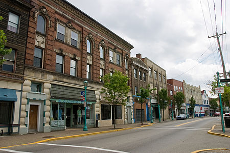
Brownsville Road is a road between Pittsburgh, at Eighteenth Street and South Avenue in Allegheny County, Pennsylvania eastwards through Mount Oliver and generally highlands situated along or near the hilltops often overlooking (and sometimes taking shorter paths cutting across the loops of the meanders of) the Monongahela River. It has had several names over its history, and was also known at the Red Stone Road and the period it was a Plank Road managed as a toll road, the Brownsville Plank Road, or the Brownsville Turnpike, or locally, as the area grew into a city, Southern Avenue. Along its route, it would also travel through Westmoreland County and end at its start terminus in Brownsville, Fayette County, Pennsylvania. It was a heavily used emigrant trail during the post-Revolutionary War surge in expansion west over the Allegheny Ridge to settle the now safer, now open lands of the Northwest Territory until well into the 1850s as an westward emigrant trail.
Excerpt from the Wikipedia article Brownsville Road (License: CC BY-SA 3.0, Authors, Images).Brownsville Road
Walnut Street,
Geographical coordinates (GPS) Address Nearby Places Show on map
Geographical coordinates (GPS)
| Latitude | Longitude |
|---|---|
| N 40.416 ° | E -79.986 ° |
Address
Walnut Street 208
15210
Pennsylvania, United States
Open on Google Maps


