place

Solent Way

Coastal paths in EnglandFootpaths in HampshireLong-distance footpaths in EnglandThe SolentUse British English from December 2016
NetleyRVCP West
NetleyRVCP West

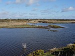
The Solent Way is a 60-mile (97 km) long-distance footpath in Hampshire, southern England. With the exception of a few inland diversions, the path follows the coast of the Solent, the sea strait that separates the mainland from the Isle of Wight. The Solent Way forms part of the E9 European Coastal Path, which runs for 5000 km (3125 miles) from Cape St Vincent in Portugal to Narva-Jõesuu in Estonia.

Excerpt from the Wikipedia article Solent Way (License: CC BY-SA 3.0, Authors, Images).

Solent Way
Park Lane, New Forest Milford-on-Sea

Geographical coordinates (GPS) Address Nearby Places
placeShow on map

Wikipedia: Solent WayContinue reading on Wikipedia

Geographical coordinates (GPS)

Latitude Longitude
N 50.724 ° E -1.6 °
placeShow on map

Address

Park Lane
SO41 0PT New Forest, Milford-on-Sea
England, United Kingdom
mapOpen on Google Maps

NetleyRVCP West
NetleyRVCP West
Share experience

Nearby Places

Milford on Sea
Milford on Sea

Milford on Sea, often hyphenated, is a large coastal village and civil parish in the New Forest district, on the Hampshire coast, England. The parish had a population of 4,660 at the 2011 census and is centred about 3 miles (4.8 km) south of Lymington. Tourism and businesses for quite prosperous retirees as well as the care sector make up large parts of its economy. Businesses include restaurants, cafés, tea rooms, small shops, garden centres, pubs and camping/lodge/caravan parks, bed-and-breakfasts and a few luxury hotels. Shops cluster on its small high street, which fronts a village green. The western cliffs are accessed by flights of steps. In common with the flatter coast by the more commercial and eastern part of Milford, they have car parks with some facilities, which, along with many apartment blocks and houses, have close views of The Needles, which are the main, large chalk rocks immediately next to the Isle of Wight. Its western coast is a large bank of shingle below green cliffs. Bathing, when seas are calm, is favourable as tides are relatively muted for the coast at this point and thin sandbanks are nearby at lower water. The eastern part of the place culminates in Hurst Castle, Hurst Point which is a 16th-century defensive fort with later modifications, which has a museum, visitor tour rides and amenities for tourists. Much of the land of the parish has been recognised and protected from dense habitation by a surrounding green belt buffer zone of land, recognising its heath soil associated with the New Forest, its biodiverse wet woodland in the west (a local nature reserve which hosts badgers, fish and many bird species) and various water type marshes including an RSPB reserve in the east.

Hurst Castle
Hurst Castle

Hurst Castle is an artillery fort established by Henry VIII on the Hurst Spit in Hampshire, England, between 1541 and 1544. It formed part of the king's Device Forts coastal protection programme against invasion from France and the Holy Roman Empire, and defended the western entrance to the Solent waterway. The early castle had a central keep and three bastions, and in 1547 was equipped with 26 guns. It was expensive to operate due to its size, but it formed one of the most powerful forts along the coast. During the English Civil War of the 1640s, Hurst was held by Parliament and was used briefly to detain King Charles I before his execution in 1649. It continued in use during the 18th century but fell into disrepair, the spit being frequented by smugglers. Repairs were made during the Revolutionary and Napoleonic Wars with France, and the castle was modernised to enable it to hold 24-pounder (10.8 kg) guns. Fresh fears of invasion followed in the 1850s, leading to heavier, 32-pounder (14.5 kg) armament being installed and new gun batteries being laid out on both sides of the castle. Technological developments rapidly made these defences obsolete, however, and a fresh phase of work between 1861 and 1874 created sixty-one gun positions in two long, granite-faced batteries alongside the older castle. These held very heavy weapons, including massive 12.5 inch, 38 ton (317 mm, 39,000 kg) rifled muzzle-loading guns. As the century progressed, these too became outdated and lighter, quick-firing guns were installed at the castle to replace them. The castle formed part of a network of defences around the entrance to the Solent during the First World War, and was re-armed again during the Second World War. The military decommissioned the fort in 1956 and it passed into the control of the Ministry of Works. In the 21st century, it is run jointly by English Heritage and the Friends of Hurst Castle as a tourist attraction, receiving around 40,000 visitors during 2015. Coastal erosion has become a growing problem despite government intervention in protecting the spit. Four lighthouses have been built at Hurst from the 18th century onwards, one of which, a high lighthouse first opened in 1867, remains in active service. In January 2021, local media reported that the castle was in urgent need of repairs due to coastal erosion, and the wall of the eastern wing partially collapsed on 26 February 2021 as the sea cut into and compromised its foundations. The World Monuments Fund included the castle on their 2022 World Monuments Watch list of most endangered sites.In September 2022, it was one of six English castles included in a fundraising campaign by English Heritage to mitigate risks of destruction due to worsening coastal erosion. They hope to gather enough funds to repair and strengthen the sea walls around the castle.