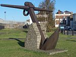
Nore

The Nore is a long bank of sand and silt running along the south-centre of the final narrowing of the Thames Estuary, England. Its south-west is the very narrow Nore Sand. Just short of the Nore's easternmost point where it fades into the channels it has a notable point once marked by a lightship on the line where the estuary of the Thames nominally becomes the North Sea. A lit buoy today stands on this often map-marked divisor: between Havengore Creek in east Essex and Warden Point on the Isle of Sheppey in Kent. Until 1964 it marked the seaward limit of the Port of London Authority. As the sandbank was a major hazard for shipping coming in and out of London, in 1732 it received the world's first lightship. This became a major landmark, and was used as an assembly point for shipping. Today it is marked by the Sea Reach No. 1 Buoys. The Nore is an anchorage, or open roadstead, used by the Royal Navy's North Sea Fleet, and to its local Command. It was the site of a notorious mutiny in 1797. The Great Nore is the cul-de-sac deep channel to the south of the Nore which opens out to the locally most deep water to the east, the Sheerness Approach.
Excerpt from the Wikipedia article Nore (License: CC BY-SA 3.0, Authors, Images).Nore
Southend-on-Sea
Geographical coordinates (GPS) Address Nearby Places Show on map
Geographical coordinates (GPS)
| Latitude | Longitude |
|---|---|
| N 51.475 ° | E 0.77777777777778 ° |
Address
Shoeburyness (Shoebury)
SS3 9AB Southend-on-Sea
England, United Kingdom
Open on Google Maps


