Woodend, New Zealand

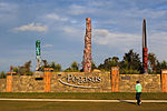
Woodend is a town in the Waimakariri District, in the Canterbury Region of the South Island of New Zealand. It may have been named because it was on the edge of what was then called the Maori Bush, or after an early settler, Thomas Wooding. It is situated with both the Waimakariri and Ashley / Rakahuri Rivers running either side. Woodend is 6.6 kilometres north of Kaiapoi and 6.3 kilometres to the east of Rangiora. Woodend is within walking distance of the town of Pegasus. The town has a population of 4,550 (June 2023). It is 25 kilometres (16 mi) north of central Christchurch, and is part of the city's metropolitan area. Woodend is located near Woodend Beach. It is possible to go swimming, surfing, walking, running and horse riding there. The Tūhaitara Coastal Park is known for its walking and mountain biking trails. The Tutaepatu Trail links Woodend Beach, Pegasus Town and Waikuku Beach.
Excerpt from the Wikipedia article Woodend, New Zealand (License: CC BY-SA 3.0, Authors, Images).Woodend, New Zealand
Woodglen Drive,
Geographical coordinates (GPS) Address Nearby Places Show on map
 Continue reading on Wikipedia
 Geographical coordinates (GPS)
| Latitude | Longitude |
|---|---|
| N -43.316666666667 ° | E 172.66666666667 ° |
Address
Woodglen Drive 12
7610 , Ravenswood
Canterbury, New Zealand
Open on Google Maps