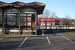
Saint-Nicolas, Liège
Liège geography stubsMunicipalities of Liège Province

Saint-Nicolas (French pronunciation: [sɛ̃ nikɔla]; Walloon: Sint-Nicolai-dlé-Lidje) is a municipality of Wallonia located ine the province of Liège, Belgium. It is effectively a part of the greater Liège conurbation stretching west from Liège city centre towards Liège Airport. As of January 1, 2006 Saint-Nicolas had a total population of 22,666. The total area is 6.84 km2 which gives a population density of 3,313 inhabitants per km2. It has the highest population density of any Belgian municipality outside the Brussels-Capital Region. Since 1977 the municipality consists of the following districts: Montegnée, Saint-Nicolas, and Tilleur.
Excerpt from the Wikipedia article Saint-Nicolas, Liège (License: CC BY-SA 3.0, Authors, Images).Saint-Nicolas, Liège
Rue Lhoneux,
Geographical coordinates (GPS) Address Nearby Places Show on map
Geographical coordinates (GPS)
| Latitude | Longitude |
|---|---|
| N 50.633333333333 ° | E 5.5333333333333 ° |
Address
Rue Lhoneux 39
4420
Liège, Belgium
Open on Google Maps


