Easton, Bristol

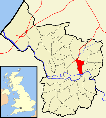
Easton is an inner city area of the city of Bristol in the United Kingdom. Informally the area is considered to stretch east of Bristol city centre and the M32 motorway, centred on Lawrence Hill. Its southern and eastern borders are less defined, merging into St Philip's Marsh and Eastville. The area includes the Lawrence Hill and Barton Hill estates. In administrative terms, Easton comprises the electoral wards of Easton and part of Lawrence Hill. It is located within the Bristol West constituency. The electoral ward of Easton includes parts of the localities of Netham and Whitehall, and a large part of Greenbank. The Bristol & Bath Railway Path passes through the ward.
Excerpt from the Wikipedia article Easton, Bristol (License: CC BY-SA 3.0, Authors, Images).Easton, Bristol
Walker Close, Bristol Easton
Geographical coordinates (GPS) Address Nearby Places Show on map
Geographical coordinates (GPS)
| Latitude | Longitude |
|---|---|
| N 51.45909 ° | E -2.56993 ° |
Address
Walker Close 43;51
BS5 0XD Bristol, Easton
England, United Kingdom
Open on Google Maps


