place

Ekeren

Districts of AntwerpPopulated places in Antwerp Province
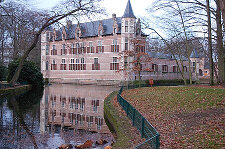
Hof van Veltwijck
Hof van Veltwijck

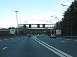
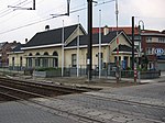
Ekeren (Dutch pronunciation: ['eːkərə(n)] (listen)) is a northern district of the municipality of Antwerp in the Flemish Region of Belgium. The suburb celebrated its 850th birthday in 2005; the name of the town was first mentioned in 1155, as "Hecerna". The name possibly originates from Vikings who settled there in the ninth century after using the oak trees.Ekeren used to be the home town of the Germinal Ekeren football club until Germinal merged with K. Beerschot V.A.C. into K.F.C. Germinal Beerschot (in 1999). The new club is based in the Olympisch Stadion in Antwerp. Ekeren is home to the Jozef Pauly municipal academy for music and diction, which has around 2000 pupils as of 2004 (also counting branches in some other districts of the city of Antwerp, and one in the nearby municipality of Kapellen). The academy hosts many musical ensembles; the Jozef Pauly flute ensemble has made concert tours to Australia and the United States. Municipal music academies in Belgium are distinct from the public educational system; attending these academies is entirely optional, and merely a hobby for most of the students. The 1 square kilometre large domain of the Oude Landen is a unique and extremely diverse natural sanctuary situated near the border with the Antwerp city district. Since it was a military area until 1972 (but not often used as such) where trespassing was strictly forbidden, nature was allowed to have its way for decades; the area now contains a rich mixture of plants and animals in eight more or less separate miniature ecosystems. The border between Ekeren and the Antwerp district was changed per 1 January 2019, which transferred several Antwerp neighbourhoods with about 5,000 inhabitants to Ekeren. Ekeren is also the hometown of well known Belgian/American musician Christian Olde Wolbers of legendary American music group Fear Factory

Excerpt from the Wikipedia article Ekeren (License: CC BY-SA 3.0, Authors, Images).

Ekeren
Kloosterstraat, Antwerp

Geographical coordinates (GPS) Address Nearby Places
placeShow on map

Wikipedia: EkerenContinue reading on Wikipedia

Geographical coordinates (GPS)

Latitude Longitude
N 51.283333333333 ° E 4.4166666666667 °
placeShow on map

Address

Kloosterstraat 123
2180 Antwerp
Antwerp, Belgium
mapOpen on Google Maps

Hof van Veltwijck
Hof van Veltwijck
Share experience

Nearby Places

Royers Lock
Royers Lock

The Royers lock (Dutch Royerssluis) is a tidal lock located in Belgium, giving access to the right bank docks in the Port of Antwerp and the Albert Canal. Although it was built for sea-going vessels, it is now mostly used by riverboats. The construction of the lock started in 1893 and was finished in 1908. The lock is 180 metres (590 ft) long and 22 meters (72 feet) wide. The operational depth (TAW) is 6.42 meters (21.1 feet). The lock was built to accommodate the extension of the docklands towards the north. Both the Bonaparte lock (Dutch: bonapartesluis) and the Kattendijk lock (Dutch: kattendijksluis) would not be able to cope with the growing traffic and the increasing size of new ocean ships. The lock is named after the Antwerp city engineer Gustaaf Royers (1848–1923). The lock has three sliding gates constructed out of steel with caissons that allow to take ballast. The gates slide on a system of rollers on rails at the bottom at right angles to the longitudinal axis of the lock and disappear into special storage chamber or recess built into the sidewall of the dock. After a gate closes, it is ballasted with water and has to deballast before it opens again. There is one gate at each end of the lock and one in between (100 meters from the lower gate). The middle gate had to allow a faster turning time but the gain was very little so the gate was put out of service. For the first time, electrical engines were used to operate the gates. Road traffic can always use at least one of the two bridges. The Royers bridge (Dutch royersbrug) is on the side of the river Scheldt. The Lefèbvre bridge (Dutch Lefèbvrebrug) is on the side of the Siberiadok, originally named Afrikadok in 1887, but during the Cold War renamed to Lefèbvredok and now part of the Amerikadok. To prevent association of the name Siberia with the USSR during the cold war, a new name was chosen after Théo Lefèvre, who was prime minister of Belgium at the time. The Royers bridge consists of a road deck on top of the gate and a lift bridge on top of the storage chamber. When opening the lower gate, the bridge is lifted to about 15° to allow the gate to slide inside the storage chamber. The original Lefèbvre bridge has been replaced and now consists of the road deck on top of the gate and a rolling bridge accessible from the sides, to cover the storage chamber.