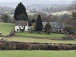
Folly Tower, Pontypool
Buildings and structures in TorfaenFolly buildings in WalesFolly towers in the United KingdomPontypoolRebuilt buildings and structures in Wales ... and 3 more
Tourist attractions in TorfaenTowers completed in the 1760sTowers in Wales

The Folly Tower (Welsh: Tŵr Ffoledd) is a folly located within the grounds of a working farm, close to Pontypool Park, Torfaen, South Wales (Grid ref: SO 2954902550). It is a prominent local landmark above the A4042 Pontypool to Abergavenny road and overlooks Pontypool to the west and rural Monmouthshire to the east. The Folly is octagonal in shape and roughly 40 ft (12 m) high and is approximately 1,000 ft (305 m) above sea level on the eastern hill range of the Eastern Valley of Monmouthshire, just south of Mynydd Garn-Wen. Less than a mile from the folly is the Shell Grotto.
Excerpt from the Wikipedia article Folly Tower, Pontypool (License: CC BY-SA 3.0, Authors, Images).Folly Tower, Pontypool
Old Cobbled Road,
Geographical coordinates (GPS) Address External links Nearby Places Show on map
Geographical coordinates (GPS)
| Latitude | Longitude |
|---|---|
| N 51.71678 ° | E -3.0219 ° |
Address
Folly Tower (292m)
Old Cobbled Road
NP4 8RD , Goetre Fawr
Wales, United Kingdom
Open on Google Maps


