Parleys Canyon

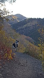
Parleys Canyon is a canyon located in the U.S. state of Utah. The canyon provides the route of Interstate 80 (I-80) (and previously the Lincoln Highway, U.S. Route 40, and a railroad) up the western slope of the Wasatch Mountains and is a relatively wide, straight canyon other than near its mouth. The mountain pass at the top of the canyon is known as Parleys Summit. With an elevation of 7,120 feet (2,170 m), the pass is the highest point along I-80 in the state of Utah. Both features are named for Parley P. Pratt, an early settler of the Salt Lake Valley and leader of the Church of Jesus Christ of Latter-day Saints who surveyed the area to find a better transportation route through the Wasatch Mountains than the previous route which traversed Emigration Canyon.
Excerpt from the Wikipedia article Parleys Canyon (License: CC BY-SA 3.0, Authors, Images).Parleys Canyon
Bonneville Shoreline Trail - Parley's Pointe Section, Salt Lake City
Geographical coordinates (GPS) Address Nearby Places Show on map
 Continue reading on Wikipedia
 Geographical coordinates (GPS)
| Latitude | Longitude |
|---|---|
| N 40.711944444444 ° | E -111.79805555556 ° |
Address
Bonneville Shoreline Trail - Parley's Pointe Section
Bonneville Shoreline Trail - Parley's Pointe Section
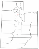
84109 Salt Lake City
Utah, United States
Open on Google Maps