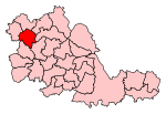
Lanesfield
Areas of WolverhamptonUse British English from March 2015
Lanesfield is a district now within the boundaries of Wolverhampton, specifically in the city council's Spring Vale ward. Lanesfield lies within the Ancient Manor of Sedgley and was a rural village for many years until the growth of the Black Country's industries. Lanesfield's name originates from the Lane family who lived where the area now stands. Originally, Lanesfield was known as Lane's Field.
Excerpt from the Wikipedia article Lanesfield (License: CC BY-SA 3.0, Authors).Lanesfield
Birmingham New Road, Wolverhampton
Geographical coordinates (GPS) Address Nearby Places Show on map
Geographical coordinates (GPS)
| Latitude | Longitude |
|---|---|
| N 52.556 ° | E -2.102 ° |
Address
Thompsons Crown Green Bowling Club
Birmingham New Road
WV4 6LR Wolverhampton
England, United Kingdom
Open on Google Maps


