place

Eaglesham

Architectural conservationCivil parishes of ScotlandEagleshamHistory of East RenfrewshirePopulated places established in 1769
Villages in East Renfrewshire

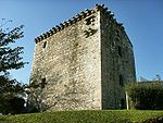
Eaglesham ( EE-gəl-səm) is a village in East Renfrewshire, Scotland, situated about 10 miles (16 km) south of Glasgow, 3 miles (5 km) southeast of Newton Mearns and south of Clarkston, and 4 miles (6.4 km) southwest of East Kilbride. The 2011 census revealed that the village had 3,114 occupants, down 13 from the 2001 census (3,127). Eaglesham is distinctive in being built around the Orry, a triangular park area of common land about 1⁄3 mile (540 m) in length, interspersed with trees and divided in the centre by the Eaglesham Burn. The ancient seat of the Earls of Eglinton. In the 17th century Eaglesham was a small market town. Today's village was founded in 1769 by Alexander Montgomerie, 10th Earl of Eglinton. It had at one time handloom weaving and a cotton-mill. Many of its buildings are category B or C listed buildings, and the planned village area is a conservation area. Eaglesham was designated Scotland's first outstanding conservation area in 1960. It is likely that there has been a place of worship here since the 5th or 6th centuries. The village is an example of an early Scottish planned village.

Excerpt from the Wikipedia article Eaglesham (License: CC BY-SA 3.0, Authors).

Eaglesham
Montgomery Street,

Geographical coordinates (GPS) Address Website Nearby Places
placeShow on map

Wikipedia: EagleshamContinue reading on Wikipedia

Geographical coordinates (GPS)

Latitude Longitude
N 55.739444 ° E -4.273333 °
placeShow on map

Address

Eaglesham Parish Church

Montgomery Street 16
G76 0AS
Scotland, United Kingdom
mapOpen on Google Maps

Website
eagleshamparishchurch.co.uk

linkVisit website

Share experience

Nearby Places

Jackton
Jackton

Jackton is a small village lying just on the western periphery of East Kilbride in South Lanarkshire, on the B764 road (otherwise known as the 'Eaglesham Road') connecting it to the village of Eaglesham. It is also adjacent to Thorntonhall, and the two villages share a newsletter, the Peel News, derived from the name of the road connecting the two. The settlement, as well as an area of surrounding farmland going as far as Lindsayfield was designated as a Community Growth Area for East Kilbride in South Lanarkshire's Local Development Plan 2. The development of new build housing, additional retail locations, and a new primary school are planned and under construction as of March 2023. Jackton lies approximately 150 metres (490 ft) above sea level. It is also the site of one of the two Scottish Training Centres for Police Scotland. The area is served by Thorntonhall railway station, which is around 1+1⁄2 miles (2.4 km) away, and Hairmyres railway station, which is around 1.3 miles (2 km) away. The Gill Burn runs through the outskirts of the settlement. There is only one bus stop on each side of the road for the village. The only buses running through are the 395/396 run by Henderson Travel. The nearby fields to the immediate southeast of Jackton have received planning approval to be the site of a large Community Growth Area (housing estate) which will entirely engulf the small village. The development, creating a continuous built-up area over 1.5 square miles (3.9 km2) to connect with Lindsayfield, will include a primary school and a new link road. There will also be a large roundabout at the current hamlet. In 2019 it was approved to build a further 70 homes in the area, consisting of 4 and 5 bedroomed properties.In 2019, one of the streets in the area was the scene of gunfire, which caused a large police presence while it was investigated.The area is represented by the local Jackton and Thorntonhall Community Council. The community lies on the very western edges of the South Lanarkshire Council boundary, and also the UK Parliament constituency of East Kilbride, Strathaven and Lesmahagow, as well as the Scottish Parliament Constituency of East Kilbride.

Hairmyres
Hairmyres

Hairmyres is an area of East Kilbride in South Lanarkshire, Scotland, situated on the west side of the town, close to the main road to Eaglesham and Kilmarnock (also with access to the major A726 Queensway/Glasgow South Orbital dual carriageway), and is 2+1⁄4 miles (3.5 kilometres) from the Glasgow City Council boundary at the Carmunnock Bypass and nine miles (fourteen kilometres) south of the city centre of Glasgow. Falling under the council's East Kilbride West ward, it gives its name to University Hospital Hairmyres, the general hospital for the town and surrounding area which originally opened in 1904, long before development as a designated new town after World War II. The district railway station (on the branch of the Glasgow South Western Line) is at the bottom of the hospital access road; trains are operated on a half-hourly basis by ScotRail to Glasgow Central and East Kilbride. Next to Hairmyres Station is the UK government's Department for International Development, the joint headquarters of which is at 22 Whitehall, London. DFID (formerly ODA) relocated part of its operation to this site1- in c.1980 following a government initiative to create employment in a region subject to major job losses following years of industrial decline.The area now has a small shopping area known as The St James Retail Park. It is easily identifiable by its yellow and orange coloured walls. It hosts a few services such as eateries, a hairdresser and a vet.