place

Godfreyhole

Derbyshire DalesDerbyshire geography stubsHamlets in Derbyshire
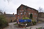
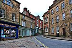
B5035 at Godfreyhole

Godfreyhole is a hamlet in Derbyshire, England. It is located at the junction of the B5035 and West End roads, 2 miles (3.2 km) west of Wirksworth, the population taken at the 2011 Census also included in the civil parish of the same name.

Excerpt from the Wikipedia article Godfreyhole (License: CC BY-SA 3.0, Authors, Images).

Godfreyhole
Rise End Lane, Derbyshire Dales

Geographical coordinates (GPS) Address Nearby Places
placeShow on map

Wikipedia: GodfreyholeContinue reading on Wikipedia

Geographical coordinates (GPS)

Latitude Longitude
N 53.08 ° E -1.598 °
placeShow on map

Address

Rise End Lane

Rise End Lane
DE4 4PU Derbyshire Dales
England, United Kingdom
mapOpen on Google Maps

B5035 at Godfreyhole
Share experience

Nearby Places

Callow, Derbyshire
Callow, Derbyshire

Callow is a village and a civil parish in the Derbyshire Dales District, in the English county of Derbyshire. At the 2011 Census the population of the civil parish was less than 100. Details are included in the civil parish of Kirk Ireton. It is near the small town of Wirksworth and the reservoir Carsington Water. Callow is recorded as Caldelawe in 1086 as having two caracutes of land as a berewick (supporting farm) of nearby Wirksworth. Callow Hall (not to be confused with Callow Hall at Ashbourne) is a moated site with a seventeenth century gritstone double-bayed main farmhouse building constructed over a thirteenth century undercroft.Callow was one of the manors of the Duchy of Lancaster in the Middle Ages and was involved in a dispute between the Duchy and the Stathams of Morley, who had a tenancy at Callow. "30 mares, 30 Ox, 30 cows and 20 bullocks worth 100 marks were taken from Duchy of Lancaster lands at Morley, Callow and Wirksworth and (the Stathams) cut down John of Gaunt’s trees to the value of £100, dug in his mine, assaulted his free tenants and serfs, destroyed their tenements and practiced such oppressions at Ralph Statham’s court that many of his (John of Gaunts) tenants had left". Ralph Statham died on 13 June 1380 but his sons carried on their feud with the Duchy. On 20 June 1381 Philip of Okeover, one of John of Gaunt's knights with his retainers, struck back at the Stathams with an attack on their lands at Callow. This feud continued in an on-off kind of way throughout the 1380s, as it is recorded again, in 1387. Callow was also one of the lead ore producing manors close to Wirksworth and in 1822 lead miners sinking a shaft at the Dream Mine, on Stainsborough Hill at Callow, discovered the remains of a prehistoric woolly rhinoceros.

Hopton Hall
Hopton Hall

Hopton Hall is an 18th-century country house at Hopton, near Wirksworth, Derbyshire. It is a Grade II listed building. The Manor of Hopton, anciently the seat of the de Hopton family, was acquired by the Gell family in 1553 by Ralph Gell (1491–1564) who also purchased lands at Darley Abbey and Rocester.John Gell was created a baronet in 1642 (see Gell baronets). The Baronetcy was extinct in 1719 and the estate passed to John Eyre in 1732 via his mother Katherine Gell, daughter of 2nd baronet John Gell, at which point Eyre added the surname of Gell. The house has its origins in the 16th century when it was built by Thomas Gell as a two-storey, three-bay manor house. It was extended and remodelled by Philip Eyre Gell in the late 18th century. The north entrance front has three storeys and seven bays, flanked by tower wings with pyramidal roofs.Notable members of the Gell family include the religious patron Katherine Gell, Philip Gell's younger brother, Admiral John Gell and Philip's son Sir William Gell.Philip Gell's daughter and heir married William Pole Thornhill MP, on whose death the estate passed to his kinsman Henry Pole, later known as Henry Chandos-Pole-Gell (High Sheriff of Derbyshire) in 1886. The estate of some 3,700 acres (15 km2) was broken up in the 20th century, a major part being sold to a water authority for the creation of Carsington Reservoir. The house itself was put up for auction in 1989, passing out of the family. The present owner is Sir Bill Thomas and his family, a former senior vice president of Hewlett-Packard Europe who was drafted in by Ed Miliband to chair Labour's "small business taskforce". Thomas and his wife Julie have opened their formal gardens and lake to the public during February and early March for the woodland Snowdrop Walk and during the summer to the Rose Garden. Both periods allow access to the 30 acres (12 ha) of grounds and 2 km (1.2 mi) of signposted paths.The document collection of the Gell family of Hopton Hall is held by the Derbyshire Record Office.

Middleton-by-Wirksworth

Middleton or Middleton-by-Wirksworth is an upland village and civil parish lying approximately one mile NNW of Wirksworth, Derbyshire, England. Middleton was, in 1086, a berewick (a supporting farm) of the town and manor of Wirksworth. Middleton was formerly known for its lead mines and high quality limestone quarries, including the underground quarry site at Middleton Mine. The Middleton Mine networks underground for approximately 25 miles (40 km) with tunnels on three different levels running under Middleton Moor to the Hopton Wood quarry works at the other side of the hill below Ryder Point Works’. Part of the tunnel collapsed in the 1980s leaving a noticeable depression in the ground above on the eastern side of Middleton Moor. The population of the parish as taken at the 2011 Census was 775.The attraction towards Middleton becoming a village had much to do with the fact that it is one of the few Derbyshire villages in the limestone area that has a ‘perched’ water table due to the impervious volcanic rock and shale formations within its topology. The availability of water was the incentive behind it becoming a choice of settlement. Middleton formed originally in the Saxon times as a small farming hamlet which settled around a very high spring. The former Cromford and High Peak Railway passes close by the village. The local quarries were linked to this line by a short branch spur, Killer's Branch, part of which now forms the track bed of the Steeple Grange Light Railway. The branch line was operational until the late 1960s. In the 1970s, the disused track bed of the Cromford and High Peak Railway and some surrounding land were purchased by the Derbyshire County Council and the Peak Park Planning Board, who then worked collaboratively to turn the former railway into the 17-mile (27 km) High Peak Trail for walkers and cyclists. Middleton Top lies near the southern end of the trail, which starts at High Peak Junction. There is a car park and visitor centre at Middleton Top, where cycles may be hired. Middleton Top Engine House (grid reference SK275552) houses a preserved steam engine formerly used to haul trains up the 700-yard (640 m) long 1-in-8 (12.5%) gradient of Middleton Incline. The engine, built by the Butterley Company of Ripley in 1829, still runs for demonstration purposes and is occasionally open to the public. The northern part of the village on the west side of the main road out towards New Road is called 'The Hall' due to the location of the now demolished Middleton Hall. The cold winter of 1947 combined with the exposed nature of Middleton meant that snow was present even during the summer following the heavy snowfall. Middleton is dependent on the market town of Wirksworth for many of its services, such as its health centre, leisure centre, high school (the Anthony Gell School) and nearby shops, petrol and so on. The closest railway station to Middleton is Wirksworth on the Ecclesbourne Valley Railway.

Haarlem Mill
Haarlem Mill

Haarlem Mill, on the River Ecclesbourne in Wirksworth, Derbyshire, was an early cotton mill. Built by Richard Arkwright, it was the first cotton mill in the world to use a steam engine, though this was used to supplement the supply of water to the mill's water wheel, not to drive the machinery directly.The site of the mill, including an older corn mill, was leased by Arkwright in 1777. Construction of the mill building in brick and stone was completed by June 1780, and the reported death of a young man attempting to climb on the water wheel suggests that it was operational at this date. After initially investigating the purchase of a steam engine from the Birmingham firm of Boulton and Watt, Arkwright installed a reciprocating steam engine, probably manufactured by Francis Thompson of Ashover, to supplement the occasionally inadequate water supply. This was a medium-sized engine with a 26-foot-long (7.9 m) beam, an 18-foot-diameter (5.5 m) flywheel a 30-inch-diameter (760 mm) cylinder and a stroke of 5 feet (1.5 m). Similar to engines commonly used at the time to pump out nearby mines, it operated 24 hours a day, powering two pumps.By 1789 the mill was employing almost 200 people, but it was sold by Arkwright three years later. The base of the original building survives, but the upper three floors have since been rebuilt. The empty grade II* listed building was listed on Historic England's Heritage at Risk Register but in 2018 was noted that a major phase of repair and conversion work had been completed.