place

Northwich Woodlands

Forests and woodlands of CheshireNorthwichParks and open spaces in CheshireUse British English from September 2013
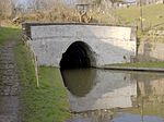
Carden's Ferry Bridge

Northwich Woodlands (formerly Northwich Community Woodlands) is an area of 373 hectares of publicly accessible countryside near Northwich in Cheshire, England. It comprises nine separate woods, country parks, lakes and parks, many of which are connected to each other via footpaths and other rights of way. Much of the land was formerly industrial and used for mining salt and manufacturing chemicals. The extraction of salt caused subsidence leading to the formation of pools known as flashes. The land became derelict during the 20th century as the salt industry contracted. Much of the area has now been reclaimed for the purposes of conservation and recreation and forms part of the Mersey Forest initiative.

Excerpt from the Wikipedia article Northwich Woodlands (License: CC BY-SA 3.0, Authors, Images).

Northwich Woodlands
Oakwood Lane,

Geographical coordinates (GPS) Address Nearby Places
placeShow on map

Wikipedia: Northwich WoodlandsContinue reading on Wikipedia

Geographical coordinates (GPS)

Latitude Longitude
N 53.264 ° E -2.555 °
placeShow on map

Address

Oakwood Lane

Oakwood Lane
CW8 4HG
England, United Kingdom
mapOpen on Google Maps

Carden's Ferry Bridge
Share experience

Nearby Places

Barnton, Cheshire
Barnton, Cheshire

Barnton is a civil parish and village in the northwest region of England, just outside the town of Northwich, in the unitary authority of Cheshire West and Chester and the ceremonial county of Cheshire. It lies north and east of the Trent & Mersey Canal which goes through two tunnels (Barnton and Saltersford) to the west of the village. The village can roughly be divided into four parts: the old village which grew northeastwards from the southwest corner; the more up-market properties northwest-wards along and to the west of the main Runcorn Road (A533); the council-built estate to the north west, largely between Townfield Lane and Runcorn Road; and the more modern estates (the largest known as the Locke estate after the builders) to the north and east. The village has no easily identifiable centre with some shops along the Runcorn Road and others by the new Health Centre in Lydyett Lane. There is currently only one pub, a small number for such a large village and greatly fewer than there were 100 years ago. The parish church is Christ Church in Church Road in the old part of the village; there are also Catholic, Methodist and Pentecostal churches. Barnton F.C. were founder members of the Mid Cheshire Football League and now compete in the North-West counties league division one south. The new village hall (the Memorial Hall) is located next to the Barnton F.C. ground off Townfield Lane. The village also has a cricket club which is located close to Barnton School which is also on Townfield Lane. Below the village where the main A533 crosses the River Weaver, on 19 August 1659, at the Battle of Winnington Bridge, a Parliamentary army of 5,000 men under the command of General John Lambert defeated a rebel Royalist army of 4,000 men under the command of Sir George Booth. A plaque marking this was erected on the bridge in August 2009 by the Northwich & District Heritage Society, 350 years after the battle commenced.The Parish Church, Christ Church, Barnton was completed in 1842 and the Vicarage stands proudly on Church Road overlooking the Winnington Village housing estate. Further along at Church Road junction stands the old Police Station, which was built in 1902 for the sergeant who lived on Bells Brow. It contained an office, an interview room and three cells. There is still has a row of back-to-back houses on Bell's Brow at the top of Barnton Hill built in 1810 to accommodate Brunner Mond labourers. Barnton became known as "Jam Town" in the late 1800s due to so many people owning and not renting their homes. "People in Barnton eat Jam butties so that they can own not only their own houses, but buy their neighbours too!". In December 2018, a wooden carving of a young boy eating a Jam Sandwich was unveiled in honour of the sacrifices for home ownership in the village. The statue was named the 'Jam Butty Boy', and is located on the A533 (Runcorn Road) that runs through the village.

The Grange School, Northwich

The Grange School is an independent day school near Northwich, Cheshire, England, a member of the Headmasters' and Headmistresses' Conference. Founded in 1933 as a preparatory school, in 1978 the school made the unusual progression to the opening of a secondary school and now teaches pupils of all school ages.The school is divided across two sites; the Junior School and the Senior School and Sixth Form. The Junior school has six forms, for National Curriculum Years 1 to 6, as well as a Reception class. The senior school has First, Second, Third, Fourth and Fifth Forms, for Years 7 to 11, plus a Lower and Upper Sixth Form for Years 12 and 13.The Junior School is in Beechwood Avenue, Hartford, near Northwich, the Senior School in Bradburns Lane, Hartford. The school has its own theatre, built in 2005 as part of the Senior School campus and named the Grange Theatre. It can be hired for community and conference use. The school also has a £6m purpose-built Sport Centre that is used by the school and the Hartford community.Extra-curricular activities include music, drama, rowing with the Grange School Rowing Club, and a Duke of Edinburgh's Award scheme. There is also a Community Service programme and the school has had a link with a school in the Gambia for many years.In 2023 there were 157 pupils in the school's Sixth Form. Almost all school leavers progress to higher education. Former pupils are called Old Roburians, from the school's Latin motto, E Glande Robur, meaning "from an acorn, an oak".