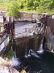
Saint-Timothée, Quebec
Communities in MontérégieFormer municipalities in QuebecMontérégie geography stubsPages with non-numeric formatnum argumentsPopulated places disestablished in 2002 ... and 2 more
Salaberry-de-ValleyfieldUse Canadian English from January 2023

Saint-Timothée is a former municipality located in the Montérégie region of Quebec, Canada, on Île-de-Salaberry in the St. Lawrence River. It occupied the middle third and largest area of the island, which is part of the Hochelaga Archipelago. The municipality is flanked by the cities of Beauharnois to the east, and to the west by Salaberry-de-Valleyfield, which Saint-Timothée was merged with on January 1, 2002.
Excerpt from the Wikipedia article Saint-Timothée, Quebec (License: CC BY-SA 3.0, Authors, Images).Saint-Timothée, Quebec
Boulevard Pie-XII,
Geographical coordinates (GPS) Address Nearby Places Show on map
Geographical coordinates (GPS)
| Latitude | Longitude |
|---|---|
| N 45.29 ° | E -74.041111111111 ° |
Address
Boulevard Pie-XII 30
J6S 6C2 , Saint-Timothée
Quebec, Canada
Open on Google Maps


