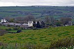
Cunnilear Camp
Devon building and structure stubsHill forts in DevonUnited Kingdom archaeology stubs
Cunnilear Camp is an Iron Age hill fort close to the village of Loxhore in Devon, England. It is on a hillside forming a promontory above the River Yeo to the south of the village, at approximately 110 metres (360 ft) above sea level.
Excerpt from the Wikipedia article Cunnilear Camp (License: CC BY-SA 3.0, Authors).Cunnilear Camp
Goodleigh Road, North Devon Bratton Fleming
Geographical coordinates (GPS) Address Nearby Places Show on map
Geographical coordinates (GPS)
| Latitude | Longitude |
|---|---|
| N 51.1141 ° | E -3.9826 ° |
Address
Earthworks
Goodleigh Road
EX31 4TE North Devon, Bratton Fleming
England, United Kingdom
Open on Google Maps


