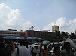
Bangalore Urban district

Bangalore Urban district, is the most populous district in the Indian state of Karnataka. It is surrounded by the Bangalore Rural district on the east and north, the Ramanagara district on the west and the Krishnagiri district of Tamil Nadu on the south. Bangalore Urban district came into being in 1986, with the partition of the erstwhile Bangalore district into Bangalore Urban and Bangalore Rural districts. Bangalore Urban has five taluks: Hebbala (Bangalore North), Kengeri (Bangalore South), Krishnarajapura (Bangalore East), Yelahanka (Bangalore North Additional) and Anekal. The city of Bangalore is situated in the Bangalore Urban district and is the headquarters of the district. The district has 2 divisions, 5 talukas, 17 hoblies, 872 villages, 11 rural habitations, 5 towns, 1 tier-three city and 1 tier-one city, administered by 96 Village Panchayats (Grama Panchayitis) 97 Taluk Panchayats (Taluk Panchayitis), 5 Town Municipal Councils (Purasabes), 1 City Municipal Council (Nagarasabe) and 1 City Corporation (Mahanagara Palike).The district had a population of 6,537,124 of which 88.11% is urban as of 2001. As of Census 2011, its population has increased to 9,621,551, with a sex-ratio of 908 females/males, the lowest in the state and its density is 4,378 people per square km.
Excerpt from the Wikipedia article Bangalore Urban district (License: CC BY-SA 3.0, Authors, Images).Bangalore Urban district
Bengaluru Cottonpete (West Zone)
Geographical coordinates (GPS) Address Nearby Places Show on map
 Continue reading on Wikipedia
 Geographical coordinates (GPS)
| Latitude | Longitude |
|---|---|
| N 12.970214 ° | E 77.56029 ° |
Address
560053 Bengaluru, Cottonpete (West Zone)
Karnataka, India
Open on Google Maps