place

Munster, Ontario

Designated places in OntarioNeighbourhoods in OttawaUse Canadian English from January 2023
Munster ON
Munster ON

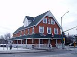
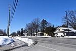
Munster, Ontario (also known as Munster Hamlet) is a large village situated south-west of Stittsville, west of Richmond and north of North Gower. The total population, as of the 2016 Canadian Census was 939, a decrease of 24.4% from the 2011 Canadian Census figure of 1,242.Munster was established as a post office in the Goulbourn Township by 1866; Thomas Tubman served as postmaster.Since 1 January 2001, it has been a part of the City of Ottawa. This was part of a massive amalgamation, resulting in the various municipalities within the former Regional Municipality of Ottawa–Carleton combining to form the larger city that exists today. Munster was home to the Anglican parish church of St. Stephens, which closed in the 1960s. At that time, Munster was a simple cross-roads village of a handful of houses. In the 1970s, a rural suburb, marketed as Munster Hamlet, added about 400 houses to the community. The community was built in four quadrants. The church was then re-opened as the Munster branch of the Ottawa Public Library. After the amalgamation into the City of Ottawa, some in Munster, as a rural suburb of the city, remain opposed to the amalgamation - refer to Carleton County, Ontario for more information. Munster has a restaurant, United Church, Loyal Orange Lodge # 917 (warrant issued in 1875), Ladies Orange Benevolent Association # 164, Apprentice Boys of Derry - No Surrender Club - Ottawa Branch and is the site of Saunders Farm, which has outdoor mazes and a Halloween theme park. Munster is named after the province of Munster, in Ireland. Public high school students in this area go to South Carleton High School in Richmond and middle school students go to Goulbourn Middle School. The Ottawa-Carleton District School Board used to run an elementary school named Munster Elementary School which closed in 2015.

Excerpt from the Wikipedia article Munster, Ontario (License: CC BY-SA 3.0, Authors, Images).

Munster, Ontario
Bleeks Road, Ottawa

Geographical coordinates (GPS) Address Nearby Places
placeShow on map

Wikipedia: Munster, OntarioContinue reading on Wikipedia

Geographical coordinates (GPS)

Latitude Longitude
N 45.166666666667 ° E -75.933333333333 °
placeShow on map

Address

Bleeks Road

Bleeks Road
K0A 3P0 Ottawa (Rideau-Jock)
Ontario, Canada
mapOpen on Google Maps

Munster ON
Munster ON
Share experience

Nearby Places

Stittsville
Stittsville

Stittsville is a suburban community, part of the Canadian capital of Ottawa, Ontario. It is within the former Goulbourn Township. A part of the National Capital Region, Stittsville is immediately to the southwest of Kanata, adjacent to Richmond and about 20 km (12 mi) west of Downtown Ottawa. The urban part of the community corresponds to Stittsville Ward on Ottawa City Council, and has been represented by Glen Gower since 2018. As of 2021, Stittsville ward had a population of 46,430.Three school boards are represented in the area: Ottawa Catholic School Board, Ottawa-Carleton District School Board and Centre-East French Catholic School Board; Sacred Heart Catholic High School, Frederick Banting Secondary Alternate Program and École secondaire catholique Paul-Desmarais are the high schools. Stittsville is home to multiple municipal services: Ottawa Fire Services' station 81, Ottawa Police Service 211 Huntmar station, the Stittsville branch of the Ottawa Public Library. It also has a branch of ServiceOntario.Founded in 1854, the original location of the village was centred around Carp Road and Hazeldean Road; this area is now called Old Stittsville. In 1870, the Carleton Country Fire destroyed most of the buildings in the community. Villagers rebuilt around the newly constructed Canadian Pacific Railway. In 1990, the line was decommissioned, and its path is now part of the Trans-Canada Trail, running perpendicular to Stittsville Main Street, along Abbott Street East.

Stittsville station

Stittsville Transitway Station is a bus-stop on Ottawa, Ontario's transitway served by OC Transpo buses. It located on Shea Road at the Goulbourn Recreation Complex in Stittsville, Ontario. It is the western terminus of some route 61 trips. A park and ride facility is also located in Stittsville but it is not served by the 61 (only express route 262 runs by the facility near Carp Road and Highway 417). Service on route 61 to/from this station generally operates every 30 minutes during all time periods, except 15 minute peak service on route 61C (eastbound in the morning and westbound in the afternoon) and hourly frequencies on weekend evenings.Service on route 61 and route 61C have been shortened to start/end at the Goulbourn Recreation Complex on Shea Road. Route 62 provides service on Granite Ridge Drive, previously served by route 61 and 61C.As of 28 June 2015, route 96A trips were replaced by route 92 (now route 62). Route 62 operates on Campeau Drive between Kanata Avenue and Eagleson Road, replacing local route 164. At the same time, both route 61 and route 62 were shortened to start/end at St-Laurent Station, as the eastern leg of the Transitway is being converted to LRT for the Confederation Line by 2018. Service on route 62 otherwise is the same as route 96A within Kanata and Stittsville. Route 62 only services Stittsville during weekday peak periods and weekday midday at 30 minute headway (as was the case with route 96A).