Goulbourn Township, Ontario
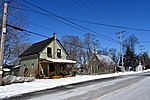
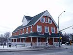
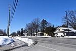
Goulbourn Township, Ontario, was formed in 1818, roughly 20 km southwest of downtown Ottawa, with the first major settlement occurring in Richmond. Other communities in the township include Stittsville, Munster, and Ashton. Stittsville is the largest community in the township, owing in part to its proximity to Kanata and the Queensway. The township was amalgamated into the current City of Ottawa in 2001. According to the Canada 2001 Census: Population: 23,604 (approx. 39,250 with original boundaries) % Change (1996-2001): 22.5 Dwellings: 7,975 Area (km².): 271.32 Density (persons per km².): 87.0 At the 2006 census the population of Goulbourn had increased to 28,583. At the 2011 census, the population had increased to 36,320. At the 2016 census, the population had increased to 40,010.Three quarters of the population (30,032) live in Stittsville. Richmond has a population of 4,833 (4,055 in the population centre) and the remaining 5,145 live in rural parts of the Township.Goulbourn took its name from Henry Goulburn, Undersecretary of State for War and the Colonies from 1812 to 1826.
Excerpt from the Wikipedia article Goulbourn Township, Ontario (License: CC BY-SA 3.0, Authors).Goulbourn Township, Ontario
Conley Road, Ottawa
Geographical coordinates (GPS) Address Nearby Places Show on map
Geographical coordinates (GPS)
| Latitude | Longitude |
|---|---|
| N 45.183333333333 ° | E -75.916666666667 ° |
Address
Conley Road 2750
K0A 3P0 Ottawa (Rideau-Jock)
Ontario, Canada
Open on Google Maps


