place

Eugenia, Ontario

Communities in Grey CountyUse Canadian English from January 2023
Eugenia Falls
Eugenia Falls

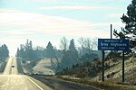
Eugenia is a small community in the municipality of Grey Highlands, Grey County, in Southwestern Ontario, Canada, located just north of the community of Flesherton. An unincorporated hamlet of Artemesia Township for most of its history, Eugenia was amalgamated into the Grey Highlands in 2001. Due to nearby Lake Eugenia, Eugenia Falls, the Bruce Trail and the ski resorts of the Beaver Valley, it has become a popular tourist and cottage destination. The nearby Eugenia Power Station has the highest head of water of any hydroelectric generator in Ontario, and has provided a significant amount of electricity to the provincial grid for a century.

Excerpt from the Wikipedia article Eugenia, Ontario (License: CC BY-SA 3.0, Authors, Images).

Eugenia, Ontario
Inkerman Street, Grey Highlands

Geographical coordinates (GPS) Address Nearby Places
placeShow on map

Wikipedia: Eugenia, OntarioContinue reading on Wikipedia

Geographical coordinates (GPS)

Latitude Longitude
N 44.311666666667 ° E -80.518888888889 °
placeShow on map

Address

Inkerman Street 196
N0C 1E0 Grey Highlands
Ontario, Canada
mapOpen on Google Maps

Eugenia Falls
Eugenia Falls
Share experience

Nearby Places

Wareham, Ontario
Wareham, Ontario

Wareham is a community in Grey County, Ontario. It is about 80 km northwest of Brampton, Ontario and about 60 km west of Barrie, Ontario. It is south of The Blue Mountains, Ontario and of the Grey Highlands. Wareham is close to the Osprey Wetland Conservation Lands. Both the Saugeen Valley Conservation Authority and the Nottawasaga Valley Conservation Authority bought land here to protect the headwaters of several important rivers. The Osprey Wetlands are in the headwaters of the Saugeen River, as well as the Grand, the Beaver of Grey County, the Mad, and a tributary of the Nottawasaga River. This Wetland is a raised bog. " Wareham as a community dates back to roughly the European Settlement of this area, about the 1850s. A branch of the Saugeen River runs through the centre of Wareham - and was the reason for settlement here. (The current crossroads of Centre Line A and Sideroad 41.) Originally there were three small water mills grouped around this corner. Remains of one of the largest of these, in the form of poured concrete bracketing the river, can be found to the SE, upstream from the intersection. The Hamlet of Wareham originally included a general store (now the location of the Church Shed / Wareham Forge) on the NW corner, and a blacksmith's shop on the NE corner. A red brick church, located about 50 m to the west on Centre Line, replaced the original wooden structure on the Davison farm about a mile east of the current location, about 1930. The original wood frame school house is located on the east side of SR 41, about 150 m south. (Both the church and the schoolhouse are now private residences.) " It is the home of Darrell Markewitz, an artisan blacksmith who designed the living history program for L'Anse aux Meadows, Newfoundland for Parks Canada. The Wareham Forge has been in operation since 1992 (the old 'Wareham Church Shed' building).