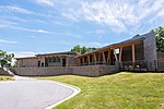
Lake Toxaway

Lake Toxaway is the largest privately held lake in North Carolina. The lake, developed by the Lake Toxaway Company, is man-made and covers 640 acres (2.6 km2) 60 feet (18 m), and the shoreline is 14 miles (23 km). Water sources for the lake include multiple free-flowing mountain streams with the Toxaway River being the main source. The lake flows out onto Toxaway Falls and then continues down the Toxaway River. The main road through the Lake Toxaway area is U.S. Highway 64, a typical winding mountain road with tight turns. Lake Toxaway history encompasses two distinct time periods. The first era which began in 1890 ended with the collapse of the earthen dam in 1916. In 1960 the second era began when the Lake Toxaway Company purchased the land and rebuilt the lake.
Excerpt from the Wikipedia article Lake Toxaway (License: CC BY-SA 3.0, Authors, Images).Lake Toxaway
Indian Trace,
Geographical coordinates (GPS) Address Nearby Places Show on map
Geographical coordinates (GPS)
| Latitude | Longitude |
|---|---|
| N 35.1345063 ° | E -82.9407895 ° |
Address
Indian Trace
Indian Trace
28747
North Carolina, United States
Open on Google Maps


