place

Scotter

Civil parishes in LincolnshireRiver TrentUse British English from December 2013Villages in LincolnshireWest Lindsey District
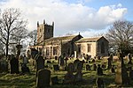
Scotter Green geograph.org.uk 1410395

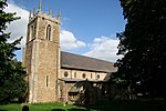
Scotter is a large village and civil parish in West Lindsey, Lincolnshire, England, situated between Scunthorpe and Gainsborough.The population of the parish was recorded as 2,591 in the 2001 census, increasing to 3,065 at the 2011 census.The parish church is dedicated to St Peter. It is in the Scotter with East Ferry ecclesiastical parish in the Scotton and Scotter Group of parishes, in the Manlake Deanery. Other churches in the group are Scotton and Northorpe. On the other side of Trent is the Deanery of Axholme. The village has several shops, a village hall, a community centre, and a primary school. The school has approximately 280 pupils of age range 4–11. The village hall was opened on 12 July 1985 by Birgitte, Duchess of Gloucester.

Excerpt from the Wikipedia article Scotter (License: CC BY-SA 3.0, Authors, Images).

Scotter
Messingham Road, West Lindsey

Geographical coordinates (GPS) Address Nearby Places
placeShow on map

Wikipedia: ScotterContinue reading on Wikipedia

Geographical coordinates (GPS)

Latitude Longitude
N 53.498965 ° E -0.666311 °
placeShow on map

Address

Messingham Road

Messingham Road
DN21 3UQ West Lindsey
England, United Kingdom
mapOpen on Google Maps

Scotter Green geograph.org.uk 1410395
Share experience

Nearby Places

Scotterthorpe
Scotterthorpe

Scotterthorpe is a hamlet in the civil parish of Scotter and the West Lindsey district of Lincolnshire, England. It is 2.5 miles (4.0 km) south from the M180 motorway, 9 miles (14 km) north-east from Gainsborough, 5 miles (8 km) south from Scunthorpe, and 1 mile (1.6 km) north-east from the village of Scotter. In the 1086 Domesday Book Scotterthorpe is written as "Scaltorp", in the West Riding of Lindsey and the Hundred of Corringham. It comprised 12 households, 4 villagers and 8 freemen, with 2 ploughlands and a meadow of 30 acres (0 km2). In 1066 Alnoth and Eskil were Lords of the Manor, which, by 1086, had been transferred to the Abbey of St Peter, Peterborough, which was also Tenant-in-chief. Mills states that the name of village of "Scalthorpe" derives from the Old Scandinavian: "an outlying farmstead or hamlet of a man called Skalli".English Heritage calls an earlier deserted medieval village of Scotterthorpe, "Scawthorpe", being just south-west of the present settlement, with evidence of tofts (homesteads with land), and indicating that there is no mention of its existence later than 1100 CE.Scotterthorpe is recorded in the 1872 White's Directory as a hamlet of Scotter, others being Susworth and Cotehouses. Revenue and taxes came from the "Town and Constable's Land", created after the early 19th- century enclosure of Scotter, with above 9 acres (0.04 km2) given to Scotterthorpe to support the hamlet as a constablewick [historically an area of land under the charge and jurisdiction of an appointed constable who would oversee parish civil and criminal law, and church law]. There were nine farmers in the hamlet.

Northorpe, West Lindsey

Northorpe is a village and civil parish in the West Lindsey district of Lincolnshire, England, about 8 miles (13 km) north-east from the town of Gainsborough. The population of the civil parish at the 2011 census was 126.Today the parish includes the deserted medieval village and former civil parish of Southorpe, whose population declined during the 15th century, and the church, dedicated to Saint Martin, which was pulled down in the early 16th century. Southorpe existed as a separate civil parish from 1858 to 1932, when it was abolished to enlarge that of Northorpe. The site of Southorpe is a scheduled monument.It is possible both villages existed at the time of Domesday Book of 1086, as the village of "Torp" is listed five times, and includes a total population of 40 households.The parish church is dedicated to Saint John the Baptist and is a Grade I listed building built of limestone and dating from the 12th century with later additions and a restoration of 1905. There are several 17th-century monuments in the church to the Monson family. At one time the churchyard was said to be haunted by an example of the Black Dog apparition, by the name of the Bargest.Northorpe village hall is a Grade II listed former National school with datestone of 1846. It opened as a school in 1848 and closed in 1932 as Northorpe CE School.Northorpe railway station opened in 1848 and closed in 1964.Northorpe has two Halls: the timber-framed Northorpe Old Hall is a Grade II listed ruin dating from the 16th century, and Northorpe Hall is a Grade II listed limestone and yellow brick built house dating from 1872.

Bottesford Preceptory

Bottesford Preceptory was sited at Bottesford, just to the south of Scunthorpe, in Lindsey, England. It was on low-lying land, near the Bottesford Beck, about 3 miles (5 km) to the west of the escarpment of the Lincoln Cliff limestone upland, and about the same distance to the east of the River Trent. A preceptory was a community of the Knights Templar who lived on one of that order's estates in the charge of its preceptor. A preceptory also referred to the estate and its buildings. The present Bottesford Manor is believed to have been the gatehouse to the preceptory. Templars Bath, a spring in the field behind Bottesford Manor, is now hardly discernible, being simply a gathering of stones. The bath has been attributed to the Romans but others believe it was a dipping bath or well used by the Templar workers. It was once used as a "magic" health-giving spring. Travellers would drink its waters and leave cloth offerings (a "rag well"). This healing property was probably associated with its position near a Templar hospital. The only distinctive Templar artefact found here was an ancient gravestone with a large cross upon it. It was covering a body buried in a grave that had been placed at the angle formed by the north wall of the chancel and the east wall of the north transept, though this description is inconsistent with a normal Templar round church. Archaeologists excavated the Templar fields nearby in 1983, but little was found and the land was back-filled.