Rushbury
Civil parishes in ShropshireUse British English from April 2012Villages in Shropshire

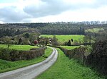
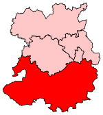
Rushbury is a village and civil parish in Shropshire, roughly five miles from Church Stretton and eight miles from Much Wenlock. Nearby villages include Cardington, Longville in the Dale, Ticklerton and Wall under Haywood. Longville and Wall lie within Rushbury parish. Rushbury is a quiet rural community, with a Church of England church and primary school.
Excerpt from the Wikipedia article Rushbury (License: CC BY-SA 3.0, Authors, Images).Rushbury
Rushbury Road,
Geographical coordinates (GPS) Address Nearby Places Show on map
Geographical coordinates (GPS)
| Latitude | Longitude |
|---|---|
| N 52.522 ° | E -2.719 ° |
Address
Rushbury Road
SY6 7DY
England, United Kingdom
Open on Google Maps


