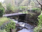
Clydach Gorge
The Clydach Gorge (also known as Cwm Clydach) is a steep-sided valley in south-east Wales down which the River Clydach flows to the River Usk. It runs for 5.6 kilometres (3.5 mi) from the vicinity of Brynmawr in Blaenau Gwent eastwards and northeastwards to Gilwern in Monmouthshire. The Gorge was one of the first locations in the region to be industrialised though it still retains its natural environment. It has long been an important transport corridor between Abergavenny and the lowlands of Monmouthshire and the northeastern quarter of the South Wales Coalfield. It is now exploited by the A465 Heads of the Valleys trunk road which runs between Abergavenny and Swansea and which serves the Heads of the Valleys sub-region. The Gorge is included within the Brecon Beacons National Park and is a tourist destination in its own right, with facilities including a picnic site, waymarked footpaths, the National Cycle Network and car parking alongside the River Clydach, easily reached from the Heads of the Valleys Road. It includes Smart's Bridge, a cast iron bridge and the remains of a late 18th-century ironworks which are now a Scheduled Ancient Monument. There are also limeworks.
Excerpt from the Wikipedia article Clydach Gorge (License: CC BY-SA 3.0, Authors).Clydach Gorge
Heads of the Valleys Road,
Geographical coordinates (GPS) Address Nearby Places Show on map
Geographical coordinates (GPS)
| Latitude | Longitude |
|---|---|
| N 51.812 ° | E -3.122 ° |
Address
Heads of the Valleys Road
Heads of the Valleys Road
NP7 0LW , Llanelly
Wales, United Kingdom
Open on Google Maps


