place

Clydach House, Llanelly

Grade II* listed buildings in MonmouthshireGrade II* listed housesHouses completed in 1693
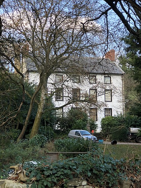
Clydach House, Llanelly

Clydach House, Llanelly, Monmouthshire is a house dating from 1693. Constructed as the home for the manager of an ironworks in the nearby Clydach Gorge, it remains a private residence and is a Grade II* listed building.

Excerpt from the Wikipedia article Clydach House, Llanelly (License: CC BY-SA 3.0, Authors, Images).

Clydach House, Llanelly
Doctor's Pitch,

Geographical coordinates (GPS) Address Nearby Places
placeShow on map

Wikipedia: Clydach House, LlanellyContinue reading on Wikipedia

Geographical coordinates (GPS)

Latitude Longitude
N 51.8184 ° E -3.1137 °
placeShow on map

Address

Doctor's Pitch

Doctor's Pitch
NP7 0HD , Llanelly
Wales, United Kingdom
mapOpen on Google Maps

Clydach House, Llanelly
Share experience

Nearby Places

Grwyne Fawr
Grwyne Fawr

The Grwyne Fawr is a river in the Brecon Beacons National Park in south Wales. A section of it forms the administrative border between Powys and Monmouthshire and also of the historic counties of Brecon and Monmouth. The river and its major tributary the Grwyne Fechan flow into the River Usk at Glangrwyney.The name probably originates from gweryn or gwerynau and mawr/fawr meaning 'large river at the wet place'. The Gwryne Fawr rises at Blaen Grwyne Fawr on the southern slopes of Rhos Dirion in the Black Mountains and follows a southeastward course for several miles, its flow interrupted by the presence of Grwyne Fawr Reservoir, the only waterbody within this range of hills. Some way below the reservoir, Mynydd Du Forest clothes the sides of the valley. Though a public road penetrates the valley as far as the north end of the forest, the valley is very sparsely populated. It is only approaching the hamlet of Partrishow that the valley takes on a farmed appearance. The river now heads west along a valley whose alignment is guided by the presence of a geological line of weakness known as the Neath Disturbance. To the west, the Grwyne Fechan takes a parallel course to that of its larger neighbour. It rises on the southern slopes of Waun Fach and gathers a number of tributary streams from the broad ridge which separates it from the Grwyne Fawr. Though there are numerous conifer plantations, the valley has a more open aspect than that of the Grwyne Fawr. The two rivers join near the village of Llanbedr and head south as the Grwyne Fawr through the hamlet of Llangenny to their confluence with the River Usk at Glangrwyney.