place

Gooimeer

AlmereBlaricumGeography of Gooise MerenHuizenLakes of the Netherlands
Landforms of FlevolandLandforms of North HollandTourist attractions in FlevolandTourist attractions in North Holland
Gooimeer
Gooimeer

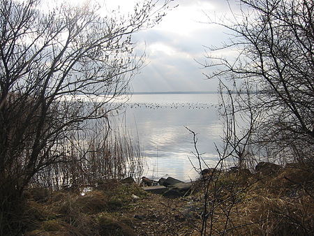
The Gooimeer (Gooi Lake) is a bordering lake in the Netherlands between the southeastern part of North Holland (the Gooi) and Flevoland. There is a railroad bridge over the narrow west side, between Weesp and Almere Muziekwijk, with a parallel highway bridge, the Hollandse Brug. The narrow eastern border of the lake is crossed by two parallel highway bridges. On the south bank of Gooimeer, which used to be the IJsselmeer, before the creation of the new polder Flevoland, the old cities of Naarden and Huizen can be found. The Naarderwoonbos, part of the Naarderbos, was built in the eighties. It is situated directly adjacent to the southern shore of the Gooimeer. The Gooimeer is related to the crash of El Al Flight 1862 in 1992, as the two right-hand side jet engines separated from the plane and fell into the lake, witnessed by a fishing off-duty police officer. The plane suffered serious damage to its right wing after losing the engines, and continued on for eight minutes until it crashed into the Bijlmermeer apartment complex, killing all of the occupants of the aircraft as well as several residents of the apartment complex. See also the maps at Zuiderzee Works and bordering lakes.

Excerpt from the Wikipedia article Gooimeer (License: CC BY-SA 3.0, Authors, Images).

Geographical coordinates (GPS)

Latitude Longitude
N 52.322777777778 ° E 5.1958333333333 °
placeShow on map

Address

Naarden


Gooise Meren
North Holland, Netherlands
mapOpen on Google Maps

Gooimeer
Gooimeer
Share experience

Nearby Places

Almere Haven
Almere Haven

Almere Haven is the oldest borough of Almere (although the first houses of Almere were built in the neighborhood now known as Oostvaardersdiep in Almere Buiten). Although Almere Haven does not have its own railway station, it is well-connected to Amsterdam and the rest of Almere by a good bus rapid transit system.Almere Haven has a small harbour, as well as a marina and is surrounded by large forests of poplars containing buzzards, foxes, small deer, and owls. The closest forests are Beginbos and Waterlandsebos. Almere Haven features a mall that, for the most part, closely resembles the downtown area of a small town. Along the moat called Kerkgracht (inside the mall), it also features canal houses, which resemble old canal houses found in Downtown Amsterdam. This was done to make the first citizens (in 1975) feel at home, as they were people who had previously lived in Amsterdam. The first permanent building inside the mall was the multifunctional building De Roef, which closed down a long time ago. The building is still actively used; currently it is home to a Vögele Mode store.The first permanent school of Almere (Haven) was built in 1978 in the neighborhood De Werven. Its name was De Bijenkorf. As more schools were built in Almere and younger people and families settled in other parts of the city, De Bijenkorf became less important and eventually ended up with just a handful of teachers. Therefore, it was up for closure. However, instead of closing, the building burned down in December 1993 because people threw firecrackers through the mailbox. The police found out who those people were, but they never prosecuted them. The building was never restored. No trace of the building remains today because in the early 2000s, houses were built on top of the former school site. The first neighborhood of Almere Haven is De Werven. Among other houses and other things, it features a lot of greenery, a big park called Stadswerfpark, a sports center with an external playground (Playground Stadswerfpark) specifically for sports (like a soccer field and basketball court) and a public pool building. It also features a big supervised playground called De Speelhaven.Almere Haven features the most idealistic architecture in Almere, when the goal was to build a model city on the newly reclaimed land of Flevoland. The city was planned before increasing population pressure in Almere and rising property prices caused compromises on the original vision. Almost all housing developments are built to provide views of greenery and open spaces, and each group of houses is clustered around a little park (although this concept has changed in newer areas), usually with easy access to the surrounding forests, so most residents of Almere Haven do not have the sense of living in a crowded urban area. The urban area of Almere Haven does not have the inconveniences of busy traffic, car pollution, and road noise because all roads are cul-de-sacs connecting to a well-hidden ring road that provides the only car access in and out of Almere Haven, although there are sometimes traffic jams in rush hours on said ring roads (especially on the ring road Noorderdreef). The bus rapid transit system contains a large loop throughout the borough with a bus stop in almost every neighborhood.
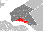
Almere Poort
Almere Poort

Almere Gate (; Dutch: Almere Poort) is a borough (stadsdeel) of Almere, Netherlands. It is the newest part of what is a new city itself, with the first building completed only in 2005. Although Almere is a planned city, Almere Poort was not in the original city plans, but is rather a result of revised urban planning in accordance to Almere's more recent development plans assuming much higher target population and more prominent role as a satellite urban centre to Amsterdam. Almere Poort is located on the western bank of the IJmeer, with the Almeerderstrand beach forming the borough's (as well as municipality's and province's) western boundary. It borders Almere Haven to the south, Almere Stad to the east and the yet-undeveloped (as of 2012) designated district of Almere Pampus to the North. The A6 motorway runs along the borough's southern border, with one exit at Poortdreef and one at Hogering, the latter of which runs along the eastern border. The Flevolijn railway line runs semi-diagonally across the borough, with local trains stopping at the borough's station Almere Poort railway station. The former Almere Strand railway station, which was serviced only during events at Almeerderstrand, was also within the boundaries of Almere Poort. It was demolished in 2012. Since then, buses run between Almere Poort station and Almeerderstrand during events. Almere Poort differs from the other boroughs and districts in that residential development does not follow the model typical for other districts of Almere, which is mostly large-scale single-family housing developments built according to a common plan. Contrary to this, the district features both high-density apartment buildings, as well as land parcels available for free private housing development. Also contrary to older districts of Almere, Almere-Poort refers to its residential areas as kwartieren rather than wijken. The designated parts of Almere Poort according to the official website of the municipality are: Homeruskwartier - featuring land plots for private housing development, with streets named after mythological beings and characters featured in the works of Homer Europakwartier - consisting of large-scale apartment buildings with an urban atmosphere, divided by the railway tracks into Europakwartier-West and Europakwartier-Oost. The street naming after European countries generally follows the east-west geographic location of countries Columbuskwartier - this residential district has streets named after famous explorers such as Christopher Columbus himself Olympiakwartier and Olympia Office Park are to be constructed around the Almere Poort railway station to form the district's multi-functional and prestigious centre. Duin which will feature beach condo's and sand hills close to the beach of Almeerderstrand and Marina Muiderzand. Cascadepark - a park between Homeruskwartier and Europakwartier with its first trees planted in 2008 Kustzone - the coastal zone along the Almeerderstrand is designated for mixed development, including residential buildings, hotels, leisure facilities and some commerce Hogekant - this commercial area in the Western extremity of the district is designated for industrial use, mostly by small and mid-sized enterprises in the craft and service sectors Middenkant - separated with a canal from the Hogekant is to provide a more high-quality neighbourhood for SMEs Lagekant - this commercial area is designated for large and international companies in the service sector