Almere

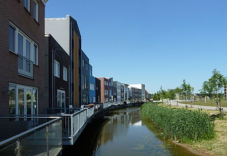
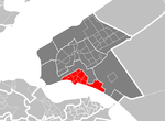
Almere (Dutch pronunciation: [ɑlˈmeːrə] (listen)) is a planned city and municipality in the province of Flevoland, Netherlands, bordering Lelystad and Zeewolde. The municipality of Almere comprises six official areas that are the districts of Almere Stad (which is further split up into Almere Stad Oost, Almere Stad West and Almere Centrum), Almere Buiten and Almere Pampus (which is currently being designed), and the boroughs of Almere Haven, Almere Hout and Almere Poort. Four of them feature official district or borough offices. Furthermore, it also comprises the unofficial historic district and neighborhood Oostvaardersdiep, which has an active semi-self-governing community, and the planned district of Almere Oosterwold. Almere is part of the Amsterdam Metropolitan Area (MRA). Almere is the newest city in the Netherlands: the land on which the city sits, the Southern Flevoland polder, was reclaimed from the IJsselmeer from 1959 to 1968. The first house was finished in 1976, and Almere became a municipality in 1984. It has the largest population of the municipalities in Flevoland with 207,904 citizens in 2019 and the 7th largest in the Netherlands. In October 2007, the city council of Almere made agreements with the government to expand the city to 350,000 inhabitants by 2030.
Excerpt from the Wikipedia article Almere (License: CC BY-SA 3.0, Authors, Images).Almere
Koetsierbaan, Almere Almere Stad
Geographical coordinates (GPS) Address Nearby Places Show on map
Geographical coordinates (GPS)
| Latitude | Longitude |
|---|---|
| N 52.366666666667 ° | E 5.2166666666667 ° |
Address
Koetsierbaan 169
1315 SN Almere, Almere Stad
Flevoland, Netherlands
Open on Google Maps


