Black Mountain (Milpitas, California)
Diablo RangeMilpitas, CaliforniaMountains of Northern CaliforniaMountains of Santa Clara County, CaliforniaMountains of the San Francisco Bay Area ... and 1 more
Santa Clara County, California geography stubs

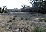
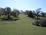
Black Mountain, also known as Mount Day, is a mountain in the Diablo Range of eastern Santa Clara County, California, east of Poverty Ridge and Arroyo Hondo, and about 10 miles (16 km) from Milpitas. The peak is one of the highest in area. The northern half of Black Mountain is an oak woodlands while the southern half is barren. Black Mountain can be clearly seen from most parts of the Santa Clara Valley including Sunnyvale, Cupertino, Mountain View and San Jose. The peak is visible from the Mount Hamilton and Monument Peak.
Excerpt from the Wikipedia article Black Mountain (Milpitas, California) (License: CC BY-SA 3.0, Authors, Images).Black Mountain (Milpitas, California)
Geographical coordinates (GPS) Address Nearby Places Show on map
Geographical coordinates (GPS)
| Latitude | Longitude |
|---|---|
| N 37.437242933 ° | E -121.700935483 ° |
Address
Santa Clara County (Santa Clara)
California, United States
Open on Google Maps


