Rancho Cañada de Pala
1839 establishments in Alta CaliforniaCalifornia ranchosRanchos of Santa Clara County, California
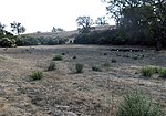
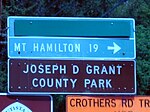
Rancho Cañada de Pala was a 15,714-acre (63.59 km2) Mexican land grant in present-day Santa Clara County, California given in 1839 by Governor Juan B. Alvarado to José de Jesús Bernal. The origin of the name Cañada de Pala is the subject of debate. The word "pala" translates as "shovel" in Spanish, but means "water", in many Native Californian dialects. The grant was in the foothills and mountains of the Diablo Range, east of San Jose and included most of what is now Grant Ranch Park and all of present-day Blue Oak Ranch Reserve.
Excerpt from the Wikipedia article Rancho Cañada de Pala (License: CC BY-SA 3.0, Authors).Rancho Cañada de Pala
Washburn Trail,
Geographical coordinates (GPS) Address Nearby Places Show on map
Geographical coordinates (GPS)
| Latitude | Longitude |
|---|---|
| N 37.35 ° | E -121.73 ° |
Address
Washburn Trail
Washburn Trail
95137
California, United States
Open on Google Maps


