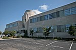
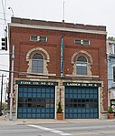
Evanston, Cincinnati
AC with 0 elementsAfrican-American history in CincinnatiHamilton County, Ohio geography stubsNeighborhoods in Cincinnati

Evanston is a neighborhood in the city of Cincinnati, Hamilton County, Ohio, United States. The population was 9,158 at the 2010 census.A mostly African-American neighborhood since the 1960s, it is known as "the educating community," and is bordered by the neighborhoods of East Walnut Hills, Hyde Park, North Avondale, and Walnut Hills, as well as the City of Norwood. The community was originally known as the village of Idlewood. It was renamed in 1893 after the city of Evanston, Illinois. Evanston was annexed to the City of Cincinnati on November 19, 1903.
Excerpt from the Wikipedia article Evanston, Cincinnati (License: CC BY-SA 3.0, Authors, Images).Evanston, Cincinnati
Montgomery Road, Cincinnati O’Bryonville
Geographical coordinates (GPS) Address Nearby Places Show on map
Geographical coordinates (GPS)
| Latitude | Longitude |
|---|---|
| N 39.1405 ° | E -84.4723 ° |
Address
Montgomery Rd & Dauner Ave
Montgomery Road
45207 Cincinnati, O’Bryonville
Ohio, United States
Open on Google Maps


