place

Australian Whale Sanctuary

1999 establishments in AustraliaCetacean research and conservationExclusive economic zone of AustraliaMarine protected areas of AustraliaUse Australian English from August 2019
Whale sanctuaries
Territorial waters Australia

The Australian Whale Sanctuary was established in 1999 to protect dolphins and whales from hunting in waters within the Australian government's jurisdiction.The sanctuary includes the whole of the Australian Exclusive Economic Zone (EEZ), which is the area 200 nautical miles (370 km) surrounding the continent of Australia and its external dependencies such as Christmas Island (in the Indian Ocean), Cocos (Keeling) Island, Norfolk Island, Macquarie Island and Heard Island and McDonald Islands, and including the EEZ adjoining the coastline of the Australian Antarctic Territory which is only recognised by the United Kingdom, New Zealand, France and Norway.The sanctuary is the scene of an ongoing controversy between Australia and Japan over whaling. In 2008 the Federal Court of Australia ruled it was illegal under Australian law for the Japanese whaling fleet to kill whales in the Sanctuary. In 2015 Kyodo Senpaku Kaisha Ltd was found guilty of wilful contempt of court and fined A$1,000,000.

Excerpt from the Wikipedia article Australian Whale Sanctuary (License: CC BY-SA 3.0, Authors, Images).

Australian Whale Sanctuary
Canberra Parkes

Geographical coordinates (GPS) Address Nearby Places
placeShow on map

Wikipedia: Australian Whale SanctuaryContinue reading on Wikipedia

Geographical coordinates (GPS)

Latitude Longitude
N -35.302086111111 ° E 149.13436111111 °
placeShow on map

Address


2600 Canberra, Parkes
Australia
mapOpen on Google Maps

Territorial waters Australia
Share experience

Nearby Places

John Gorton Building

The John Gorton Building, also referred to as the Gorton Building and formerly the Administrative Building, is a heritage listed government office located within the Parliamentary Triangle in Canberra, Australia. The office building is the administrative headquarters of the Department of Climate Change, Energy, the Environment and Water. Planned in 1924, designed in 1946 and completed in 1956, the Administrative Building is significant as a good Canberra example of the Inter-war Stripped Classical style. Key features of this style displayed by the building include: the symmetrical facades; the division of the elevations into vertical bays; the occasional use of correct Classical details; the use of a basic Classical column form; the expressed portico; the simple surface treatments; and subdued spandrels between the storeys which emphasise verticality. Design elements which retain a high level of integrity include the exterior, foyers, lift lobbies and central corridors. The Administrative Building is also part of the significant cultural landscape of the Parliamentary triangle. It occupies a prominent and strategic location flanking the land axis in accordance with the 1916 Griffin plan. Together with the later Treasury Building balancing its mass across the central lawns of the land axis, the Administrative Building contributes to the planned aesthetic qualities of the Parliamentary triangle. The building was listed on the Commonwealth Heritage List on 22 June 2004.

Parliamentary Triangle, Canberra

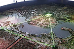
The National Triangle, which is referred to as the Parliamentary Triangle, is the ceremonial precinct of Canberra, containing some of Australia's most significant buildings. The National Triangle is formed by Commonwealth, Kings and Constitution Avenues. Buildings within the National Triangle have been located and designed intentionally for visual effect, and those of national significance are popular tourist attractions. The National Triangle was a significant feature of Walter Burley Griffin's Plan for Canberra. The apices of the triangle are Parliament House, the seat of government; the Defence Headquarters at Russell; and City Hill, representing the civilian part of Canberra. Griffin planned the city around two axes which converge in the centre of the National Triangle. The land axis connects Mount Ainslie, Capital Hill and Red Hill and extends off towards Mount Bimberi the Australian Capital Territory's highest mountain. The water axis runs at right angles to the land axis along the length of Lake Burley Griffin. The southern shore of Lake Burley Griffin bisects the National Triangle forming a smaller Triangle known as the Parliamentary Zone bounded by Kings and Commonwealth Avenues. Consistent with Walter Burley Griffin's Garden City design, the National Triangle is characterised by streets lined with large deciduous trees, and buildings set in expanses of grassed parkland. Consequently, it has a very open feel and buildings are located several minutes walk away from one another. It was Griffin's original intention for more grand government buildings to be located within the precinct, but these have not eventuated as yet. Development within the National Triangle is strictly controlled by the National Capital Authority, an agency of the Commonwealth Government (not the ACT Government) within the Department of Infrastructure, Transport, Regional Development and Communications.