Parliamentary Triangle, Canberra

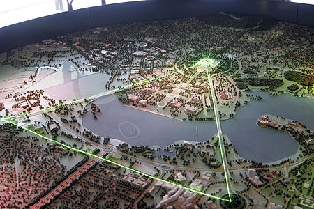
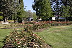
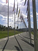
The National Triangle, which is referred to as the Parliamentary Triangle, is the ceremonial precinct of Canberra, containing some of Australia's most significant buildings. The National Triangle is formed by Commonwealth, Kings and Constitution Avenues. Buildings within the National Triangle have been located and designed intentionally for visual effect, and those of national significance are popular tourist attractions. The National Triangle was a significant feature of Walter Burley Griffin's Plan for Canberra. The apices of the triangle are Parliament House, the seat of government; the Defence Headquarters at Russell; and City Hill, representing the civilian part of Canberra. Griffin planned the city around two axes which converge in the centre of the National Triangle. The land axis connects Mount Ainslie, Capital Hill and Red Hill and extends off towards Mount Bimberi the Australian Capital Territory's highest mountain. The water axis runs at right angles to the land axis along the length of Lake Burley Griffin. The southern shore of Lake Burley Griffin bisects the National Triangle forming a smaller Triangle known as the Parliamentary Zone bounded by Kings and Commonwealth Avenues. Consistent with Walter Burley Griffin's Garden City design, the National Triangle is characterised by streets lined with large deciduous trees, and buildings set in expanses of grassed parkland. Consequently, it has a very open feel and buildings are located several minutes walk away from one another. It was Griffin's original intention for more grand government buildings to be located within the precinct, but these have not eventuated as yet. Development within the National Triangle is strictly controlled by the National Capital Authority, an agency of the Commonwealth Government (not the ACT Government) within the Department of Infrastructure, Transport, Regional Development and Communications.
Excerpt from the Wikipedia article Parliamentary Triangle, Canberra (License: CC BY-SA 3.0, Authors, Images).Parliamentary Triangle, Canberra
King Edward Terrace, Canberra Parkes
Geographical coordinates (GPS) Address Website Nearby Places Show on map
Geographical coordinates (GPS)
| Latitude | Longitude |
|---|---|
| N -35.3 ° | E 149.13333333333 ° |
Address
National Portrait Gallery
King Edward Terrace
2600 Canberra, Parkes
Australia
Open on Google Maps


