place

Maples Collegiate

1980 establishments in ManitobaEducational institutions established in 1980High schools in WinnipegManitoba school stubsSeven Oaks, Winnipeg

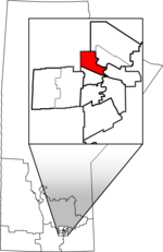
Maples Collegiate is a public high school in Winnipeg, Manitoba. It is a part of the Seven Oaks School Division. The Maples Met High School is located in the same building as the regular high school.

Excerpt from the Wikipedia article Maples Collegiate (License: CC BY-SA 3.0, Authors).

Maples Collegiate
Adsum Drive, Winnipeg Old Kildonan

Geographical coordinates (GPS) Address Nearby Places
placeShow on map

Wikipedia: Maples CollegiateContinue reading on Wikipedia

Geographical coordinates (GPS)

Latitude Longitude
N 49.9541 ° E -97.1731 °
placeShow on map

Address

Maples Collegiate

Adsum Drive
R2P 0X9 Winnipeg, Old Kildonan
Manitoba, Canada
mapOpen on Google Maps

Share experience

Nearby Places

Burrows (electoral district)

Burrows is a provincial electoral division in the Canadian province of Manitoba. It was created by redistribution in 1957 from part of Winnipeg North, and formally came into existence in the provincial election of 1958. The riding is located in the northern part of Winnipeg. Burrows is named after Theodore Arthur Burrows, who served as Lieutenant-Governor of Manitoba from 1926 to 1929. It is bordered to the east by St. Johns and Point Douglas, to the south by Wellington, to the north by Kildonan and The Maples, and to the west by Tyndall Park. The riding's boundaries were significantly redrawn in 1999, taking in a considerable amount of territory which was previously a part of the now-defunct Inkster. The riding's population in 1996 was 18,718. In 1999, the average family income was $35,575, one of the lowest rates in the province. Thirty-nine per cent of the riding's residents are listed as low-income, with an unemployment rate of 13%. One household in four has only one parent. Nineteen per cent of the riding's residents are over sixty-five years of age. The total immigrant population in Burrows is 21%, with almost one in three residents speaking a first language other than English or French. The Aboriginal population is 15%. Manufacturing accounts for 22% of Burrows' industry, with a further 15% in the service sector. The CCF and its successor the NDP have won Burrows on all but three occasions since the riding was created, with the Liberals winning the other three elections.

Inkster (electoral district)

Inkster was a provincial electoral division in the Canadian province of Manitoba. It was located in the northwestern corner of the city of Winnipeg. Officially created by redistribution in 1957, it has existed since the provincial election of 1958.The riding was named after the Inkster family, who were prominent local figures at the time of the province's creation in 1870. John Inkster was a member of Louis Riel's provisional government, while Colin Inkster was a member of the province's Legislative Council (which existed from 1871 to 1876). There were 19,246 persons living in the riding in 1996. Inkster had a broad range of income levels and a strong working-class presence (the manufacturing sector accounting for 23% of industry in 1999). Census reports from 1999 showed an average family income of $51,274, with 8.10% unemployment. Inkster had the third-largest immigrant population of all ridings in the province, at over 30% of the total population. 21% of the riding's residents are Filipino, 6% are Ukrainian, and 5% are East Indian. Only 4% of the population is above age 65. Like many other north-end Winnipeg ridings, Inkster traditionally supported the New Democratic Party and its predecessor, the Cooperative Commonwealth Federation, although Liberal Kevin Lamoureux represented the riding for all but four years from 1988 to 2010. For the 2011 election, Inkster was dissolved into The Maples and the new riding of Tyndall Park.