place

Farndale

Civil parishes in North YorkshireNorth York MoorsRyedaleUse British English from October 2018Valleys of the North York Moors
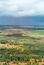
Farndale April 2009
Farndale April 2009

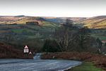
Farndale is a valley and community in North Yorkshire, England, which is known for the daffodils which flower each spring along a 7-mile (11 km) stretch of the River Dove. The valley is in the North York Moors National Park, some 11 miles (18 km) north of Kirkbymoorside, the nearest town. Pickering is some 17 miles (27 km) to the south-east and Helmsley 17 miles (27 km) to the south-west. The combined population of the civil parishes of Farndale East and Farndale West was 207 in 2011, and was estimated to have dropped to 180 by 2015.Farndale is an isolated, scattered agricultural community with traditional Yorkshire dry stone walls. The valley is popular with walkers due to its famous wild daffodils, which can be seen around Easter time all along the banks of the River Dove. To protect the daffodils the majority of Farndale north of Lowna was created a Local Nature Reserve in 1955. Farndale is home to two hamlets; Church Houses at the top of the valley and Low Mill further down. Low Mill is a tourist honeypot during daffodil season as this is where the famous daffodil walk begins. The other end of the daffodil walk is at High Mill a cluster of houses a short distance down a lane from Church Houses.

Excerpt from the Wikipedia article Farndale (License: CC BY-SA 3.0, Authors, Images).

Geographical coordinates (GPS)

Latitude Longitude
N 54.368055555556 ° E -0.97472222222222 °
placeShow on map

Address

Cross Lane

Cross Lane
YO62 7LF , Farndale East
England, United Kingdom
mapOpen on Google Maps

Farndale April 2009
Farndale April 2009
Share experience

Nearby Places

Cockayne, North Yorkshire

Cockayne is an isolated hamlet in North Yorkshire, England. It is the largest settlement in the civil parish of Bransdale, in the North York Moors national park. The nearest towns are Helmsley and Kirkbymoorside, both 10 miles (16 km) away, to the south and south east respectively.The Cleveland Way long-distance footpath crosses the northern end of Cockayne Ridge, which rises above the hamlet to the north, reaching a summit of 1,447 feet (441 m) at Cockayne Head. The settlement, under the southern tip of the ridge, is a mere 738 feet (225 m) above sea level, according to the Ordnance Survey. Cockayne is at the head of Bransdale, a southward facing valley cut into the moors. The hamlet is the furthest north that can be travelled in the dale by vehicle (apart from a track through the plantation north of the hamlet). Bransdale Lodge (or Cockayne Lodge) is a house built in the mid 19th century and once used by the Earl of Feversham as a shooting lodge. The small church of St Nicholas, now a grade II listed building, was built about 1800 as a chapel of ease in the ancient parish of Kirkby Moorside.The hamlet is, with the exception of the Church and Glebe, entirely owned by the National Trust. The overwhelming part of the 1,925 acres (779 ha) Bransdale estate was transferred to the National Trust through National Land Fund procedures in 1972 and comprises all the farmland and a small amount of woodland in the valley.Studies carried out on the heather moorland at Cockayne Head and Ridge have shown that repairing the moorland after major fires helps prevent flooding in times of heavy rain. When the moorland is burnt the peat dries out and flakes, but when the peat is allowed to grow back, it acts like a natural sponge to retain water and release it slowly over days and weeks, which helps to prevent flooding further downstream.