Steam Mills
Forest of DeanGloucestershire geography stubsUse British English from March 2015Villages in Gloucestershire

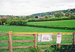
Steam Mills is a village in the Forest of Dean, west Gloucestershire, England. During the 18th and 19th centuries there were local coal mines and a steam-powered mill, which lead to the name of the village. An engineering works was established in the 1880s to support the mining.Today the village has an industrial park for businesses (including Freeminers Brewery, named after the Forest of Dean custom of free-mining), a petrol filling station and a carpet shop. The village is home to Steam Mills Primary School designed by architect Alfred Smith. The 5 acres (2.0 ha) lake is used for angling with Carp, Bream and Brown Trout being caught.
Excerpt from the Wikipedia article Steam Mills (License: CC BY-SA 3.0, Authors, Images).Steam Mills
Steam Mills Road, Forest of Dean
Geographical coordinates (GPS) Address Nearby Places Show on map
Geographical coordinates (GPS)
| Latitude | Longitude |
|---|---|
| N 51.839 ° | E -2.512 ° |
Address
Steam Mills Road
Steam Mills Road
GL14 3HY Forest of Dean
England, United Kingdom
Open on Google Maps


