place

Blowing Rocks Preserve

Florida protected area stubsNature Conservancy preservesNature centers in FloridaNature reserves in FloridaProtected areas of Martin County, Florida
South Florida geography stubs
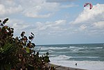
An outcropping of the Anastasia limestone formation seen along the shoreline of Blowing Rocks Preserve at low tide

Blowing Rocks Preserve is an environmental preserve on Jupiter Island in Hobe Sound, Martin County, Florida, USA. It is owned by The Nature Conservancy. It contains the largest Anastasia limestone outcropping on the state's east coast. Breaking waves spray plumes of water through erosion holes; the spray can reach heights of 50 feet (15 m). This distinctive spectacle thus earned the limestone outcrop's name. The limestone outcropping also encompasses coquina shells, crustaceans, and sand. The preserve also features several coastal ecotones, including maritime hammocks, mangrove wetlands, and beach dunes. Common native species include sea grapes, gumbo limbo, and Sabal palms. Invasive exotic plants are removed in order to preserve indigenous flora. The preserve includes an educational center, native plant nursery, boardwalk, oceanside path, and a butterfly garden. The Hawley Education Center features rotating natural history and art exhibits, and offers environmental education classes and workshops. A boardwalk along the Indian River Lagoon contains interpretive signs about the plants, wildlife and area environment.

Excerpt from the Wikipedia article Blowing Rocks Preserve (License: CC BY-SA 3.0, Authors, Images).

Blowing Rocks Preserve
South Beach Road,

Geographical coordinates (GPS) Address Nearby Places
placeShow on map

Wikipedia: Blowing Rocks PreserveContinue reading on Wikipedia

Geographical coordinates (GPS)

Latitude Longitude
N 26.9745 ° E -80.081 °
placeShow on map

Address

The Nature Conservancy Blowing Rocks Preserve

South Beach Road 574
33455
Florida, United States
mapOpen on Google Maps

An outcropping of the Anastasia limestone formation seen along the shoreline of Blowing Rocks Preserve at low tide
Share experience

Nearby Places

Jupiter Inlet Light
Jupiter Inlet Light

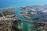
The Jupiter Inlet Light is located in Jupiter, Florida, on the north side of the Jupiter Inlet. The site for the lighthouse was chosen in 1853. It is located between Cape Canaveral Light and Hillsboro Inlet Light. The lighthouse was designed by then Lieutenant George G. Meade of the Bureau of Topographical Engineers. Meade's design was subsequently modified by Lieutenant William Raynolds. The Jupiter Inlet silted shut in 1854, forcing all building supplies to be shipped in light boats down the Indian River. Work was interrupted from 1856 to 1858 by the Third Seminole War. The lighthouse was completed under the supervision of Captain Edward A. Yorke in 1860 at a cost of more than $60,000.The lighthouse was built on a hill once thought to be an Indian shell mound or midden (and sometimes falsely rumored to be a burial mound), but which is now determined to be a natural parabolic sand dune. The top of the 105-foot (32 m) tower is 153 feet (47 m) above sea level. The light can be seen 24 nautical miles (44 km; 28 mi) at sea. The lighthouse structure is brick with double masonry walls. The outer wall is conical, tapering from 31.5 inches (800 mm) (eight bricks thick) at ground level to 18 inches (460 mm) (three bricks thick) at base of lantern. The inner wall is cylindrical and two bricks thick throughout. Circumference at base is about 65 feet (20 m) and at the top about 43 feet (13 m). The lighthouse was painted red in 1910 to cover discoloration caused by humidity. Hurricane Jeanne in 2004 sandblasted the paint from the upper portion of the tower, and the tower was repainted using a potassium silicate mineral coating.