place

Anacostia Park

AnacostiaIUCN Category VNational Capital Parks-EastNational Park Service areas in Washington, D.C.Parks in Washington, D.C.
Washington, D.C., geography stubs
Anacostia Park Section E Washington DC

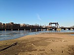
Anacostia Park is operated by the United States National Park Service. It is one of Washington, D.C.'s largest and most important recreation areas, with over 1200 acres (4.9 km2) at multiple sites. Included in Anacostia Park is Kenilworth Park and Aquatic Gardens and Kenilworth Marsh. Hundreds of acres are available for ballfields, picnicking, basketball, tennis, and the Anacostia Park Pavilion has some 3300 square feet (307 m2) of space for roller skating and special events. The Langston Golf Course offers an 18-hole course as well as a driving range, and three concession-operated marinas, four boat clubs, and a public boat ramp provide for access to the tidal Anacostia River for recreational boating. "Eagles' Nest", the headquarters of the United States Park Police helicopter aviation unit is located in Anacostia Park. Additionally, the headquarters of National Capital Parks-East is located within the park.

Excerpt from the Wikipedia article Anacostia Park (License: CC BY-SA 3.0, Authors, Images).

Anacostia Park
Anacostia Drive Southeast, Washington

Geographical coordinates (GPS) Address Nearby Places
placeShow on map

Wikipedia: Anacostia ParkContinue reading on Wikipedia

Geographical coordinates (GPS)

Latitude Longitude
N 38.8781678 ° E -76.9691416 °
placeShow on map

Address

Skating Rink

Anacostia Drive Southeast
20020 Washington
District of Columbia, United States
mapOpen on Google Maps

Anacostia Park Section E Washington DC
Share experience

Nearby Places

John Philip Sousa Bridge

The John Philip Sousa Bridge, also known as the Sousa Bridge and the Pennsylvania Avenue Bridge, is a continuous steel plate girder bridge that carries Pennsylvania Avenue SE across the Anacostia River in Washington, D.C., in the United States. The bridge is named for famous United States Marine Band conductor and composer John Philip Sousa, who grew up near the bridge's northwestern terminus. The first bridge at this location was constructed in 1804, but burned by United States armed forces in 1814 during the War of 1812. It was replaced in 1815, but the bridge burned to the waterline in 1846. The rapid growth of residential developments east of the Anacostia River led to the construction of a narrow, iron girder bridge in 1890. This bridge led to even swifter economic and residential development of the area. Efforts to replace the 1890 bridge with a modern structure began in 1931, but were not successful until 1938. The downstream (southern) span opened on December 9, 1939, to great fanfare. The upstream span was completed in December 1940 and opened on January 18, 1941. The Sousa Bridge has a partial interchange with the Barney Circle traffic circle at its northwestern end, and a partial interchange with Anacostia Freeway at its southeastern terminus. A major battle over building an Inner Loop Expressway in the District of Columbia occurred in the 1950s and 1960s. This led to the partial construction of Interstate 695 from Interstate 395 to Barney Circle, but political battles over the wisdom of further construction led to cancellation of the remaining highway—leaving Barney Circle and the northern approaches to the Sousa Bridge partially deconstructed. An attempt to build the remainder of Interstate 695 (the "Barney Circle Freeway") in the 1990s also failed. In 2010, the District of Columbia decommissioned the portion of Interstate 695 leading to Barney Circle and the Sousa Bridge, and began rebuilding the circle and approaches.