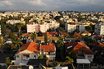
Tabsur
Arab villages depopulated prior to the 1948 Arab–Israeli WarDistrict of Tulkarm

Tabsur (Arabic: تبصر), also Khirbat 'Azzun (Arabic: خربة عزون), was a Palestinian village located 19 kilometres southwest of Tulkarm. In 1931, the village had 218 houses and an elementary school for boys. Its Palestinian population was expelled during the 1948 Arab-Israeli war.
Excerpt from the Wikipedia article Tabsur (License: CC BY-SA 3.0, Authors, Images).Tabsur
HaSadna, Ra'anana Kiryat Etgarim
Geographical coordinates (GPS) Address Nearby Places Show on map
Geographical coordinates (GPS)
| Latitude | Longitude |
|---|---|
| N 32.193888888889 ° | E 34.878888888889 ° |
Address
קאנטרי קלאב רעננה
HaSadna
4353404 Ra'anana, Kiryat Etgarim
Center District, Israel
Open on Google Maps


