Augsburg-Haunstetten

Augsburg-Haunstetten, also known as Haunstetten-Siebenbrunn is one of the seventeen Planungsräume (English: Planning district, singular: Planungsraum) of Augsburg, Bavaria, Germany. It is the largest of the seventeen Planungsräume with an area of 32.59 km² (12.58 mi²). It is one of the most heavily populated subdivisions of Augsburg, with over 25,000 inhabitants. The town of Siebenbrunn was its own entity until 1910 when it was annexed to Augsburg, and Haunstetten was its own city from 1952 until 1972, when Bavaria underwent extensive reform of its political subdivisions and Haunstetten was also annexed to Augsburg. The population stood at 26,291 as of December 31, 2010.
Excerpt from the Wikipedia article Augsburg-Haunstetten (License: CC BY-SA 3.0, Authors, Images).Augsburg-Haunstetten
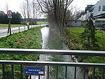
Inninger Straße, Augsburg Haunstetten-Siebenbrunn
Geographical coordinates (GPS) Address Nearby Places Show on map
Geographical coordinates (GPS)
| Latitude | Longitude |
|---|---|
| N 48.308 ° | E 10.904 ° |
Address
Inninger Straße 6
86179 Augsburg, Haunstetten-Siebenbrunn
Bavaria, Germany
Open on Google Maps
