South Seberang Perai District

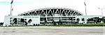
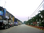
The South Seberang Perai District (Malay: Daerah Seberang Perai Selatan; abbreviated "SPS") is a district in Penang, Malaysia. It covers an area of 242 square kilometres, and had a population of 184,007 at the 2020 Census. The district is bordered by Junjong River that separates Central Seberang Perai in the north, Kedah state border in the east, Perak state border in the south and the South Channel that separates Penang Island. Rivers that flow through South Seberang Perai are Junjong River, Jawi River and Kerian River. The capital of this district is Sungai Jawi and the largest town is Nibong Tebal. Other towns such as Batu Kawan, Bukit Tambun, Simpang Ampat, Sungai Bakap and Valdor are also located in this district. South Seberang Perai is thriving with the fishing industry and agriculture. Oil palm plantations covers most parts of the area.
Excerpt from the Wikipedia article South Seberang Perai District (License: CC BY-SA 3.0, Authors, Images).South Seberang Perai District
Geographical coordinates (GPS) Address Nearby Places Show on map
 Continue reading on Wikipedia
 Geographical coordinates (GPS)
| Latitude | Longitude |
|---|---|
| N 5.2333333333333 ° | E 100.46666666667 ° |
Address
14100
Penang, Malaysia
Open on Google Maps