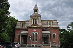
North Haverhill, New Hampshire

North Haverhill is an unincorporated community and census-designated place (CDP) in Haverhill, New Hampshire, United States. It is one of several villages in the town of Haverhill. As of the 2020 census, North Haverhill had a population of 843. The village is centered on the junction of New Hampshire Routes 10 and 116, on a bluff overlooking the Connecticut River, the western boundary of New Hampshire. It is situated in the middle of a fertile agricultural area at the western base of the White Mountains. Route 10, following the Connecticut River, connects the village of Woodsville to the north with the towns of Piermont, Orford, Lyme, and Hanover to the south. Route 116 heads east into the White Mountains, leading to the towns of Benton, Easton, and Franconia. In 1972 the county courthouse and related offices moved from Woodsville into a new office complex on Route 10, just north of the North Haverhill village center. North Haverhill has a separate ZIP code (03774) from other areas in the town of Haverhill.
Excerpt from the Wikipedia article North Haverhill, New Hampshire (License: CC BY-SA 3.0, Authors, Images).North Haverhill, New Hampshire
Dartmouth College Highway,
Geographical coordinates (GPS) Address Phone number Nearby Places Show on map
Geographical coordinates (GPS)
| Latitude | Longitude |
|---|---|
| N 44.089722222222 ° | E -72.026666666667 ° |
Address
North Haverhill Post Office
Dartmouth College Highway 2730
03774
New Hampshire, United States
Open on Google Maps


