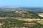
Khirbet Qeiyafa

Khirbet Qeiyafa (Arabic: خربة قيافة), also known as Elah Fortress and in Hebrew as Horbat Qayafa (Hebrew: חורבת קייאפה), is the site of an ancient fortress city overlooking the Elah Valley and dated to the first half of the 10th century BCE. The ruins of the fortress were uncovered in 2007, near the Israeli city of Beit Shemesh, 30 km (20 mi) from Jerusalem. It covers nearly 2.5 ha (6 acres) and is encircled by a 700-meter-long (2,300 ft) city wall constructed of field stones, some weighing up to eight tons. Excavations at site continued in subsequent years. A number of archaeologists, mainly the two excavators, Yosef Garfinkel and Saar Ganor, have claimed that it might be one of two biblical cities, either Sha'arayim, whose name they interpret as "Two Gates", because of the two gates discovered on the site, or Neta'im; and that the large structure at the center is an administrative building dating to the reign of King David, where he might have lodged at some point. This is based on their conclusions that the site dates to the early Iron IIA, ca. 1025–975 BCE, a range which includes the biblical date for the biblical Kingdom of David. Others suggest it might represent either a North Israelite, Philistine, or Canaanite fortress, a claim rejected by the archaeological team that excavated the site. The team's conclusion that Khirbet Qeiyafa was a fortress of King David has been criticised by some scholars.
Excerpt from the Wikipedia article Khirbet Qeiyafa (License: CC BY-SA 3.0, Authors, Images).Khirbet Qeiyafa
Rabi Yeva Sava, Beit Shemesh Ramat Bet Shemesh D
Geographical coordinates (GPS) Address External links Nearby Places Show on map
Geographical coordinates (GPS)
| Latitude | Longitude |
|---|---|
| N 31.696388888889 ° | E 34.957222222222 ° |
Address
חורבת קייאפה (מבצר האלה)
Rabi Yeva Sava
9920828 Beit Shemesh, Ramat Bet Shemesh D
Jerusalem District, Israel
Open on Google Maps


