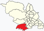
Old Hay Brook
Rivers of SheffieldUse British English from December 2016

The Old Hay Brook is a small river in Sheffield, South Yorkshire, England. It is formed from the Redcar Brook, Blacka Dike and another stream, which rise on moors to the south of Sheffield, and is joined by Needham's Dyke near Totley Grange. At Totley Rise it joins Totley Brook, to become the River Sheaf. Water from the river was used to power mills processing lead, corn and paper from at least the 17th century, which were later used for grinding scythes as the Sheffield metal industry expanded. All the mills were defunct by 1900, although some remnants including weirs and dams are still visible.
Excerpt from the Wikipedia article Old Hay Brook (License: CC BY-SA 3.0, Authors, Images).Old Hay Brook
Grove Walk, Sheffield Totley
Geographical coordinates (GPS) Address Nearby Places Show on map
Geographical coordinates (GPS)
| Latitude | Longitude |
|---|---|
| N 53.318 ° | E -1.533 ° |
Address
Grove Walk
Grove Walk
S17 4ED Sheffield, Totley
England, United Kingdom
Open on Google Maps


