Port River
Estuaries of South AustraliaKaurnaMangrove ecoregionsNature reserves in South AustraliaRivers of Adelaide ... and 2 more
Shipping channelsUse Australian English from August 2015

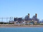
The Port River (officially known as the Port Adelaide River) is part of a tidal estuary located north of the Adelaide city centre in the Australian state of South Australia. It has been used as a shipping channel since the beginning of European settlement of South Australia in 1836, when Colonel Light selected the site to use as a port. Before colonisation, the Port River region and the estuary area were known as Yerta Bulti (or Yertabulti) by the Kaurna people, and used extensively as a source of food and plant materials to fashion artefacts used in daily life. The Port River dolphins are a popular tourist attraction.
Excerpt from the Wikipedia article Port River (License: CC BY-SA 3.0, Authors, Images).Port River
Adelaide Outer Harbor
Geographical coordinates (GPS) Address Nearby Places Show on map
Geographical coordinates (GPS)
| Latitude | Longitude |
|---|---|
| N -34.78 ° | E 138.47 ° |
Address
Freeman's Landing
5018 Adelaide, Outer Harbor
South Australia, Australia
Open on Google Maps


