São Caetano do Sul

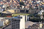
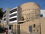
São Caetano do Sul (or São Caetano) (Saint Cajetan of the South. Portuguese pronunciation: [sɐ̃w kajˈtɐnu du ˈsuw]) is a city in São Paulo state in Brazil. It is part of the Metropolitan Region of São Paulo. The population is 161,957 (2020 est.) in an area of 15.33 km2. It is the city with the highest per capita income in Brazil (US$31,322.00 in 2010) and it also has the highest Human Development Index. It is intensely conurbated with São Paulo, Santo André and São Bernardo do Campo, causing the physical limits between cities to be lost. São Caetano do Sul, together with Ferraz de Vasconcelos, is one of two cities in the state of São Paulo that are not crossed by any state or federal highway.
Excerpt from the Wikipedia article São Caetano do Sul (License: CC BY-SA 3.0, Authors, Images).São Caetano do Sul
Avenida Pery Ronchetti, São Bernardo do Campo Nova Petrópolis (São Bernardo do Campo)
Geographical coordinates (GPS) Address Nearby Places Show on map
Geographical coordinates (GPS)
| Latitude | Longitude |
|---|---|
| N -23.7 ° | E -46.55 ° |
Address
Avenida Pery Ronchetti (Avenida Peri Ronchetti)
Avenida Pery Ronchetti
09771-180 São Bernardo do Campo, Nova Petrópolis (São Bernardo do Campo)
São Paulo, Brazil
Open on Google Maps


