Santo André, São Paulo
1553 establishments in the Portuguese EmpirePages with Portuguese IPAPopulated places established in 1553Santo André, São Paulo

Santo André (Portuguese pronunciation: [sɐ̃twɐ̃ˈdɾɛ], Saint Andrew) is a Brazilian municipality located in the Metropolitan Region of São Paulo. It is part of a group of municipalities known as the ABC Region. According to the most recent census, the population is estimated at 721,368 (2020 est.) in an area of 175.8 km². or about 43,441 Acres of landmass. It is the 15th most developed Brazilian city, and the eighth most developed city in the State of São Paulo, according to the UN. The city is also known to be the fifth best city in the country to raise children on the grounds of public and private education and health care.
Excerpt from the Wikipedia article Santo André, São Paulo (License: CC BY-SA 3.0, Authors, Images).Santo André, São Paulo
Avenida Edson Danillo Dotto, Santo André Centro (Santo André)
Geographical coordinates (GPS) Address Nearby Places Show on map
Geographical coordinates (GPS)
| Latitude | Longitude |
|---|---|
| N -23.657222222222 ° | E -46.533333333333 ° |
Address
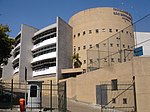
Paço Municipal de Santo André (Centro Cívico de Santo André)
Avenida Edson Danillo Dotto
09040-210 Santo André, Centro (Santo André)
São Paulo, Brazil
Open on Google Maps


