Monk Hesleden
Civil parishes in County DurhamVillages in County Durham
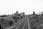
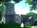
Monk Hesleden is a village and civil parish in County Durham, England. The population of the parish at the 2011 Census was 5,722. The parish is situated to the north-west of Hartlepool, and is on the North Sea coast. Monk Hesleden village is situated a short distance to the south of High Hesleden. The parish has an area of 1,091.35 hectares (4.2137 sq mi) and includes the villages or hamlets of Blackhall Colliery, Blackhall Rocks, Crimdon, Hesleden, High Hesleden and Monk Hesleden. It has a parish council.
Excerpt from the Wikipedia article Monk Hesleden (License: CC BY-SA 3.0, Authors).Monk Hesleden
Hart to Haswell Walkway,
Geographical coordinates (GPS) Address Nearby Places Show on map
Geographical coordinates (GPS)
| Latitude | Longitude |
|---|---|
| N 54.729 ° | E -1.294 ° |
Address
Hart to Haswell Walkway
TS27 4DL
England, United Kingdom
Open on Google Maps


