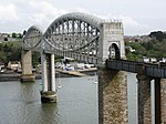
Saltash Passage
Geography of Plymouth, Devon
Saltash Passage (or Riverside) is on the Devon side of the River Tamar, opposite Saltash. It is part of St Budeaux, an area of Plymouth in Devon. Saltash Passage lies at the northern end of Wolseley Road, previously known as Ferry Road. The local railway station continues to be known as Ferry Road Station. Saltash Passage is named after the ferry route that carried passengers and vehicles between Saltash in Cornwall and Plymouth, across the River Tamar. The ferry became uneconomic following the construction of the Tamar Bridge in 1961. Saltash Passage is a popular leisure destination for the locals as well as tourists in summer.
Excerpt from the Wikipedia article Saltash Passage (License: CC BY-SA 3.0, Authors).Saltash Passage
Wolseley Road, Plymouth Barne Barton
Geographical coordinates (GPS) Address Nearby Places Show on map
Geographical coordinates (GPS)
| Latitude | Longitude |
|---|---|
| N 50.403 ° | E -4.199 ° |
Address
Wolseley Road 804
PL5 1JP Plymouth, Barne Barton
England, United Kingdom
Open on Google Maps


