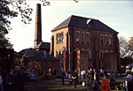
Hummersknott
County Durham geography stubsPlaces in the Tees ValleySuburbs of DarlingtonVillages in County Durham
Hummersknott is an area in the western end of Darlington, County Durham England. It is a ward in the unitary authority of Darlington. It consists of mainly post-war houses, and is closely linked to Mowden. The population of the ward taken at the 2011 Census was 3,478.The area of Hummersknott is generally regarded as the area around Hummersknott School and up to Carmel Road North. There is also a Victorian cemetery and a Catholic secondary school, Carmel RC College, which also has a sixth form.
Excerpt from the Wikipedia article Hummersknott (License: CC BY-SA 3.0, Authors).Hummersknott
Pentland Grove,
Geographical coordinates (GPS) Address Nearby Places Show on map
Geographical coordinates (GPS)
| Latitude | Longitude |
|---|---|
| N 54.523 ° | E -1.592 ° |
Address
Pentland Grove
Pentland Grove
DL3 8BA , Hummersknott
England, United Kingdom
Open on Google Maps


