Azewijn
Gelderland geography stubsMontferlandPopulated places in Gelderland

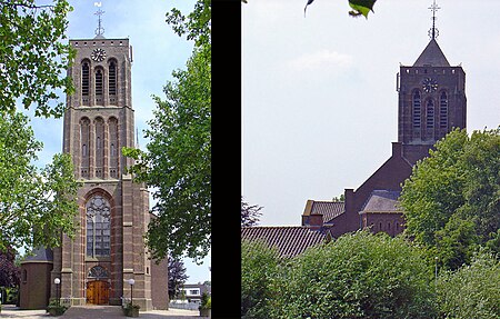
Azewijn is a village in the Dutch province of Gelderland and the municipality Montferland, and is about 3 km east of the town of 's-Heerenberg. The larger part of Azewijn is known as "Groot-Azewijn" (Greater Azewijn), with the hamlet "Klein-Azewijn" (Lesser Azewijn) about 1 km to the north.Azewijn was first mentioned in 1025 as 'Asawon'; but the etymology is unclear. The village belonged to the Kingdom of Prussia before it became part of the Netherlands in 1816. Population in 1840 was 525. St Matthews Church at Azewijn was built in 1891. It was burnt down by Germans on 31 March 1945, and was rebuilt in 1950–1951.
Excerpt from the Wikipedia article Azewijn (License: CC BY-SA 3.0, Authors, Images).Azewijn
Aswinstraat, Montferland
Geographical coordinates (GPS) Address Nearby Places Show on map
Geographical coordinates (GPS)
| Latitude | Longitude |
|---|---|
| N 51.885555555556 ° | E 6.3041666666667 ° |
Address
Aswinstraat 5
7045 BE Montferland
Gelderland, Netherlands
Open on Google Maps


