Bay View, New Zealand
Beaches of the Hawke's Bay RegionNapier, New ZealandPopulated places around Hawke BayPopulated places in the Hawke's Bay RegionSuburbs of Napier, New Zealand ... and 1 more
Use New Zealand English from January 2021
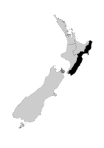
Bay View, previously known as Kai-arero and Petane, is a settlement in the Hawke's Bay region of the eastern North Island of New Zealand. It lies on State Highway 2, nine kilometres north of the city centre of Napier. The Esk River flows into the sea just to the north. Hawke's Bay Airport and the Napier suburb of Westshore lie just to the south. Bay View has been administered by the Napier City Council since the 1989 local government reforms.
Excerpt from the Wikipedia article Bay View, New Zealand (License: CC BY-SA 3.0, Authors).Bay View, New Zealand
Onehunga Road, Napier
Geographical coordinates (GPS) Address Nearby Places Show on map
 Continue reading on Wikipedia
 Geographical coordinates (GPS)
| Latitude | Longitude |
|---|---|
| N -39.428 ° | E 176.857 ° |
Address
Onehunga Road
Onehunga Road
4104 Napier
Hawke's Bay, New Zealand
Open on Google Maps